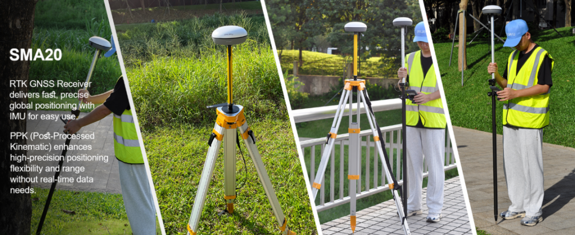
RTK GPS Surveying Equipment: SMA26 RTK Rover + Base with NOAA Certification

What is RTK GPS Surveying Equipment, and why is it essential? RTK (Real-Time Kinematic) GPS technology delivers pinpoint accuracy for surveying by using a network of base stations and satellites to provide real-time corrections. This allows for centimeter-level precision, making it indispensable for tasks that demand high accuracy, such as land mapping, construction, and infrastructure development. ... Read more