Introduction: Why Should We Care About Construction and Geodesy?
Have you ever wondered how large construction projects—such as skyscrapers, bridges, and entire city districts—are built with such incredible accuracy? Or how surveyors are able to precisely map the curves of our planet? The answer lies in the combined forces of Construction and Geodesy. This combination is the backbone of modern infrastructure development, enabling engineers to build projects that not only stand tall but also align with millimeter accuracy. The technologies involved have revolutionized how we understand the land, build on it, and even make future projections about geographic changes.

In this blog, we'll explore what Construction and Geodesy mean, delve into their market landscape, and understand the best practices to achieve excellence in your projects.
What is Construction and Geodesy?
Understanding Construction
Construction is the process of creating, modifying, or deconstructing physical structures. It spans a wide range of activities, including residential, commercial, and industrial developments, and involves multiple disciplines like architecture, engineering, and project management. Modern construction relies heavily on technology for both efficiency and precision, integrating digital tools like Building Information Modeling (BIM) and geospatial analytics to ensure structures are built to exact standards.
Defining Geodesy
Geodesy, on the other hand, is the science of measuring and understanding the Earth's geometric shape, orientation in space, and gravitational field. It plays a crucial role in surveying, providing the foundational data needed for construction projects to be aligned properly. Without geodesy, architects, surveyors, and engineers would struggle to know where to build or how to overcome challenging terrains.
Simply put, while construction focuses on building, geodesy ensures we know precisely where and how to build. Both fields intertwine seamlessly to achieve the accuracy required for today's engineering challenges.
The Market Status of Construction and Geodesy in 2023
Current Market Size and Growth
The market for construction and geodesy-related technologies is booming due to rapid infrastructure development worldwide, urbanization, and advances in technology. According to the most recent real data from 2023, the global construction market is valued at $13.6 trillion and is projected to grow at a Compound Annual Growth Rate (CAGR) of 6.3% over the next five years. By 2028, this market size is expected to reach approximately $18.4 trillion.
The geodesy equipment market, which includes GNSS (Global Navigation Satellite System) receivers, surveying instruments, and related services, is also on a growth trajectory. In 2023, this segment was estimated at $3.5 billion, with a CAGR of 5.5%. By 2028, the market size is anticipated to surpass $4.6 billion. Factors such as increased investments in smart cities, advancements in GNSS technology, and the growing need for high-precision mapping in infrastructure projects are driving this market forward.
How Does Construction and Geodesy Work Together?
Planning and Surveying
The first step in any construction project is surveying the land, and that's where geodesy comes into play. Surveying with GNSS-based technologies, such as RTK (Real-Time Kinematic), helps in setting out project boundaries and providing real-time data on elevation and terrain, which forms the basis of all subsequent construction planning.

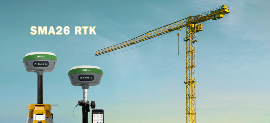
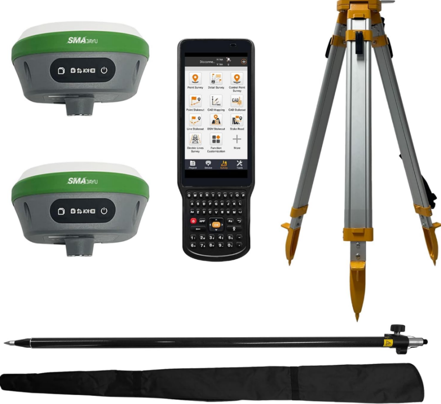
High-precision GNSS receivers, such as the SMA26 from SMAJAYU, offer extremely precise readings—sometimes down to the millimeter. Surveyors use these instruments to ensure that land plots are accurately marked, and terrain deviations are properly accounted for in the building plans.
Setting Foundations
One of the most critical phases of construction is setting the foundation. Foundations require pinpoint accuracy to ensure that the entire structure above remains stable. Here, geodetic data provides a thorough understanding of the local geology, allowing engineers to customize foundations to withstand varying loads and seismic activities.
Built-in UHF wireless modules, such as those integrated into the SMA26 GNSS receivers, allow survey teams to communicate across vast construction sites seamlessly, facilitating efficient decision-making and minimizing errors in real-time.
Continuous Monitoring
Monitoring the accuracy of construction as it proceeds is another area where construction and geodesy intersect. High-quality GNSS equipment is crucial to ensuring that no drift or shift occurs throughout the building phase. By continuously tracking data, any discrepancies can be quickly corrected, saving time and avoiding costly mistakes.
Better Solutions for Construction and Geodesy Projects
SMA26 GNSS Receiver: A Game-Changer for Surveying
Introduction to SMAJAYU's SMA26 GNSS Receiver
A successful construction project requires the right tools, and SMAJAYU's SMA26 GNSS receiver is a cutting-edge device designed for exactly this purpose. The SMA26 RTK+Pole+Tripod package ($2,834.00) is not only NOAA certified but has also gained a reputation for its reliability, functionality, and ease of use.
With 100% of users recommending it, the SMA26 boasts a range of features that make it perfect for both geodesy and construction projects:
Built-in GNSS Full-Frequency Antenna: This guarantees the accuracy required in diverse terrains, regardless of obstacles.
Long Battery Life: With a built-in battery of 10200mAh, it allows for up to 14 hours of continuous operation, crucial for work in harsh outdoor environments.
Built-in UHF Wireless Capability: Enables easy switching between base station and mobile station without the need for additional equipment.
Signal Tracking: It uses 1408 channels and the NebulasIV engine, ensuring accuracy and reliability.
Improved Accuracy with GNSS Full-Frequency Antenna
The GNSS full-frequency antenna in SMA26 allows for highly precise measurements, which is crucial for setting out baselines and alignments accurately. This level of precision is especially important when working on complex urban construction projects, where multiple buildings or infrastructure elements must be accurately placed relative to one another.
Long Battery Life Means Less Downtime
One of the common challenges in geodetic surveying is battery life. Surveyors often work in challenging environments, and recharging or replacing batteries can become cumbersome. The SMA26 GNSS receiver, with its 14-hour battery life, allows surveyors to spend more time in the field and less time worrying about equipment running out of power. This is crucial when deadlines are tight, and fieldwork must proceed without interruptions.
Seamless Communication with Built-in UHF Wireless
The built-in low-power transceiver wireless module allows for seamless communication on-site, especially for projects that cover large areas. With CSS (LoRa) Protocol, surveyors can move freely while maintaining a stable connection to the base station, which is particularly beneficial in areas with challenging topographies.
Best Practices in Construction and Geodesy Projects
Utilize High-Quality Equipment
Using high-quality geodetic and GNSS equipment, such as the SMA26, can mean the difference between success and costly delays. Cutting corners in equipment often results in inaccuracies that compound over time, affecting the stability and longevity of the entire structure.
Leverage Technology for Enhanced Precision
Modern construction and geodesy technologies, such as RTK GNSS and BIM software, should be leveraged to provide enhanced precision and efficiency. These tools make it easier to simulate the construction process beforehand, ensuring any issues can be rectified before breaking ground.
Invest in Skilled Surveyors and Engineers
Even the best equipment is useless without skilled professionals who understand how to use it effectively. Construction and geodesy projects require experts who can interpret data accurately, use equipment properly, and foresee any challenges that may arise during a project.
Conclusion: Building Smarter with Construction and Geodesy
The collaboration between Construction and Geodesy is fundamental to modern infrastructure. These two fields ensure that buildings and other structures are not only well-designed but also accurately positioned, stable, and capable of enduring the test of time.

With the market for construction and geodetic technologies growing significantly, there is no better time to embrace these advancements. By using state-of-the-art equipment such as the SMA26 from SMAJAYU and adhering to industry best practices, professionals can ensure their projects are not just completed but done so with precision, efficiency, and quality.
Whether you're in surveying, project management, or construction, staying updated with the latest tools and techniques will make your projects more successful. Don't underestimate the power of high-precision geodesy and quality construction practices—they are the key to building a smarter, more reliable future.
If you're interested in equipping your team with the SMA26 GNSS receiver for your next project, be sure to reach out to SMAJAYU for further details. The right tools make all the difference in elevating your projects to the next level.


