What is GNSS RTK and Why Does it Matter in Agriculture?
Precision farming has revolutionized how agriculture operates, and GNSS (Global Navigation Satellite System) RTK (Real-Time Kinematic) technology is at the heart of this transformation. For those unfamiliar with the technology, GNSS RTK base stations enable farmers to achieve centimeter-level accuracy in positioning, which is critical for tasks like planting, harvesting, and irrigation.

In farming, precision is key to maximizing crop yields while minimizing resources like water, seeds, and fertilizer. The GNSS RTK system ensures that machinery can follow predefined paths with incredible accuracy, reducing overlap and waste. Farmers equipped with GNSS RTK technology can save both time and resources, boosting efficiency across their operations.
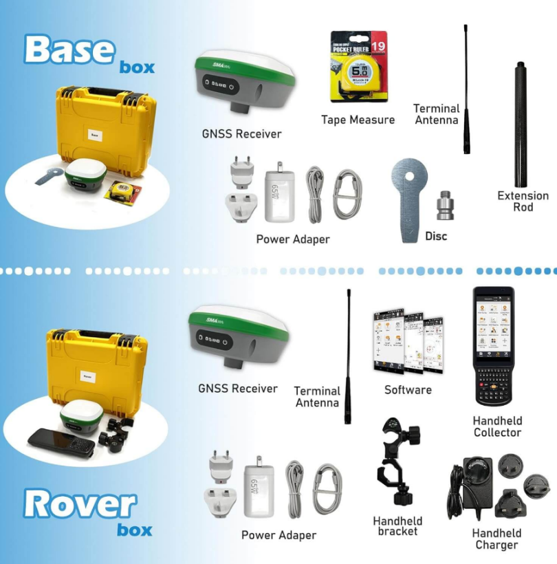
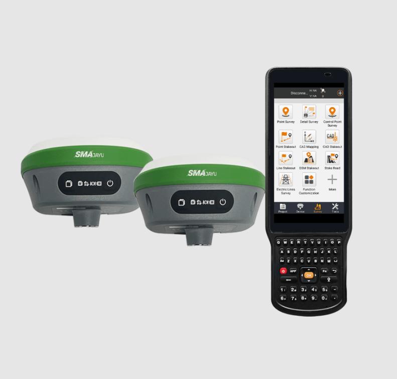
The SMA26 RTK Rover+Base is an excellent example of a GNSS RTK system tailored for precision farming. With NOAA certification, it guarantees reliable and precise operation, making it an invaluable tool for modern farmers looking to harness the power of GNSS technology.
How GNSS RTK Enhances Precision in the Field
A primary benefit of using GNSS RTK in farming is the ability to automate machinery. Tractors and harvesters can follow precise, predetermined paths using data from GNSS RTK base stations, reducing human error and ensuring optimal coverage. This accuracy helps farmers make the best use of their fields, planting or harvesting in straight lines without wasting resources.
Moreover, GNSS RTK base stations can help monitor field conditions in real-time. With data collected from sensors and machinery, farmers can adjust their operations dynamically to account for variations in soil moisture or nutrient levels. The real-time aspect of RTK ensures that these decisions are made quickly, maximizing efficiency.
Lastly, GNSS RTK allows for more accurate data collection, enabling farmers to analyze their operations over time. This historical data can be used to improve future farming seasons, making farms more efficient and profitable in the long run.
Expanding GNSS RTK Networks: What Base Stations Mean for Global Connectivity
The Growing Importance of GNSS RTK Networks
As GNSS RTK base stations become more prevalent, their role in global connectivity is expanding. Initially used for niche applications like surveying and construction, these stations are now playing a vital role in sectors like agriculture, transportation, and even autonomous systems.
In agriculture, the need for precise positioning is obvious, but the benefits of GNSS RTK networks are not limited to farms. Industries worldwide are beginning to recognize the potential of GNSS RTK for improving efficiency, reducing waste, and driving innovation. The expansion of GNSS RTK networks globally means more people and industries can benefit from ultra-precise positioning and navigation.
The SMA26 RTK Rover+Base is designed with this expanding network in mind. It supports a built-in UHF wireless module, capable of seamless communication between the base station and rovers, ensuring reliable connectivity across various applications.

How Expanding Networks Improve Global Operations
As GNSS RTK networks expand, the technology is becoming more accessible. Previously, RTK systems required a physical base station in the vicinity. Now, many operations are supported by GNSS RTK networks that cover large areas, making the technology more scalable. This is particularly important for industries like transportation, where vehicles and machinery may cover extensive distances.
For global industries, expanding GNSS RTK networks can reduce operational costs and improve efficiency. Companies can rely on accurate data to monitor their fleets, ensuring deliveries arrive on time and that vehicles are operating optimally. In the logistics sector, where margins are often thin, this level of precision can make a substantial difference.
GNSS RTK’s Role in Bridging the Digital Divide
As GNSS RTK networks grow, they can also play a role in bridging the digital divide, particularly in rural areas where connectivity has traditionally been limited. By providing precise, real-time positioning services, GNSS RTK technology can enable smarter infrastructure and logistics in underserved regions, helping drive development and innovation.
How GNSS RTK Base Stations Work: The Technology Behind Precision Positioning
The Basics of GNSS RTK Technology
GNSS RTK base stations are the backbone of high-precision positioning systems. They operate by receiving signals from multiple satellites in orbit, then processing and transmitting this data to rovers or mobile units on the ground. The key to RTK’s success is the real-time correction it provides, allowing users to achieve centimeter-level positioning accuracy.
RTK base stations work by using a fixed reference point on the Earth’s surface. By comparing the satellite data to this known point, the station can calculate and correct for errors in the satellite signals caused by atmospheric interference or other factors. The corrected data is then sent to the rover, ensuring that its position is highly accurate.
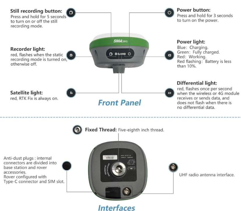
The SMA26 RTK Rover+Base offers cutting-edge technology for this process. With its built-in GNSS full-frequency antenna and high-precision positioning board, the SMA26 ensures reliable signal tracking, making it one of the most advanced systems available.
The Role of GNSS RTK Base Stations in Reducing Errors
One of the main advantages of GNSS RTK is its ability to correct for errors in satellite positioning data. Satellite signals can be distorted by atmospheric conditions, multipath effects, and other factors, leading to positioning errors. By using a fixed reference point and applying corrections in real-time, GNSS RTK base stations minimize these errors, providing accurate data.
For industries where precision is critical—such as surveying, construction, and agriculture—this error correction is essential. Without it, operations could face costly delays or inaccuracies. GNSS RTK ensures that users can trust the data they receive, improving both efficiency and safety.
Why the SMA26 RTK Base Station Stands Out
The SMA26 RTK Rover+Base is a standout device in this field due to its comprehensive feature set. With a 1408-channel Nebulas IV signal tracking system, it is capable of monitoring signals from multiple GNSS constellations simultaneously. This broad coverage ensures that the SMA26 delivers reliable, accurate positioning, even in challenging environments.
Additionally, the SMA26 includes a long-lasting battery (up to 14 hours) and advanced communication protocols like CSS (LoRa). These features make it ideal for outdoor, long-term operations, where reliability and endurance are key factors.
Improving Data Collection with GNSS RTK Base Stations: Real-World Use Cases
Precision Farming: A Case Study
Precision farming is one of the most prominent use cases for GNSS RTK base stations. In this context, RTK technology is used to guide tractors and other machinery with pinpoint accuracy. For instance, farmers can use RTK systems to plant seeds in straight rows, reducing overlap and ensuring consistent spacing between crops. This not only improves crop yields but also minimizes waste.

With tools like the SMA26 RTK Rover+Base, farmers can improve their efficiency significantly. Its advanced signal processing and high-precision capabilities make it ideal for large-scale farming operations, where accuracy is critical to success.
GNSS RTK in Construction
Another real-world application of GNSS RTK technology is in construction. Construction companies rely on precise data for tasks like grading, excavation, and laying foundations. Errors in positioning can result in costly delays and structural issues down the line.
GNSS RTK base stations provide the accuracy needed to avoid these problems. By ensuring that machinery is operating in the right locations and at the right elevations, construction teams can work faster and more efficiently. The SMA26 RTK Rover+Base, with its built-in UHF wireless capabilities, is an excellent choice for these kinds of projects.
Surveying and Mapping Applications
Surveying is perhaps the most well-known application of GNSS RTK technology. Surveyors use RTK systems to measure distances, angles, and elevations with extreme accuracy. The data collected from GNSS RTK base stations is crucial for creating detailed maps and plans for a variety of projects, from land development to infrastructure planning.
The SMA26 RTK Rover+Base’s multi-functional capabilities make it a perfect tool for surveyors. With its reliable connectivity and long battery life, it is well-suited to long-term projects in remote locations.
Autonomous Vehicles and GNSS RTK
Looking ahead, GNSS RTK technology is set to play a major role in the development of autonomous vehicles. Self-driving cars and drones require precise positioning data to navigate safely and efficiently. GNSS RTK base stations provide the accuracy needed for these systems to function, ensuring that vehicles can operate in complex environments without human intervention.
The SMA26 RTK Rover+Base is equipped with the advanced technologies needed for such applications. Its built-in IMU and 4G modules allow for seamless integration with autonomous systems, providing reliable, real-time data for navigation.
Smart Cities and Infrastructure
As cities become smarter, the need for accurate positioning data will only increase. GNSS RTK base stations will be essential for managing infrastructure, from traffic systems to utility networks. These stations will enable ultra-precise monitoring and control of urban systems, improving efficiency and reducing costs.
A Future Built on GNSS RTK Technology
The potential of GNSS RTK base stations extends beyond farming, construction, and surveying. As the technology becomes more widespread, it will form the foundation for a range of future innovations, from smart cities to fully autonomous transportation networks. Devices like the SMA26 RTK Rover+Base from SMAJAYU are leading the way, providing the precision and reliability needed for this exciting new era of technology.


