In 2024, the agricultural sector faces numerous challenges ranging from optimizing resource use to enhancing productivity and sustainability. With growing global populations and fluctuating environmental conditions, precision agriculture has become increasingly crucial. This approach relies heavily on advanced technologies like GPS surveying systems to enable precise mapping, monitoring, and management of agricultural activities.
Meeting Farming Needs with GPS Survey 2024 like R26 Surveying System Rover+Base
The SMAJAYU R26 Surveying System Rover+Base represents a significant advancement in agricultural GPS surveying technology for 2024. Designed specifically for field use, it integrates cutting-edge features that cater to the demanding requirements of modern farming practices. By offering centimeter-level positioning accuracy and robust performance across multiple satellite systems, the R26 system addresses the precise needs of farmers and agricultural professionals.
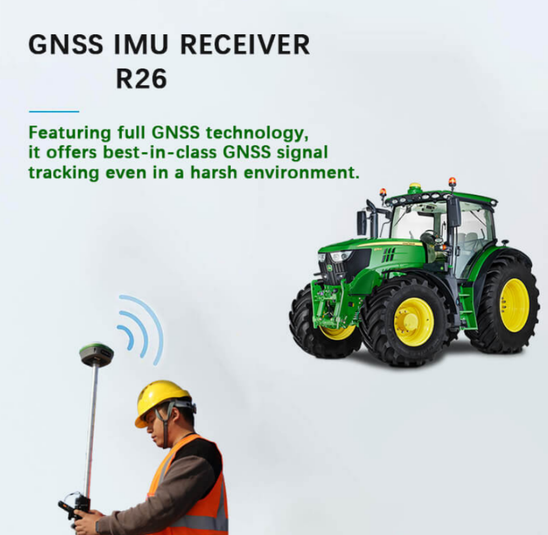
The R26 system is equipped with a Beidou/GNSS receiver, ensuring comprehensive satellite signal reception and reliable positioning capabilities even in challenging environments. Its high-precision inertial navigation RTK receiver enhances accuracy further, complemented by features like Bluetooth connectivity and a durable, field-ready design. These attributes make the R26 an indispensable tool for optimizing agricultural operations, from planting and fertilization to harvesting and land management.
Applications of GPS Survey 2024 like R26 Surveying System Rover+Base
The applications of the R26 Surveying System Rover+Base extend across various aspects of agricultural management. Primarily, it enables precise field mapping and boundary delineation, crucial for efficient land use planning and resource allocation. Farmers can utilize the system for creating accurate topographic maps, identifying drainage patterns, and optimizing irrigation layouts to minimize water wastage and enhance crop health.
Moreover, the R26 supports real-time kinematic (RTK) positioning, allowing farmers to monitor machinery and implement automated guidance systems with unparalleled accuracy. This capability is instrumental in reducing overlaps during planting and spraying operations, thereby optimizing input usage and lowering operational costs. Additionally, the system facilitates crop scouting and monitoring by providing precise location data, aiding in timely pest management and disease control strategies.
How GPS Survey 2024 like R26 Surveying System Rover+Base Works
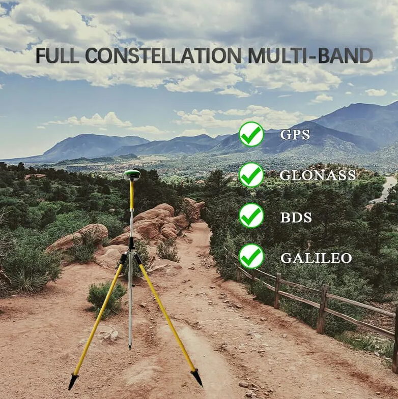
At the core of the R26 Surveying System Rover+Base is its advanced GNSS technology, which leverages global corrections services delivered via satellite and internet. This enables the system to achieve centimeter-level positioning accuracy in real-time, crucial for precision agriculture applications. The R26 seamlessly integrates signals from GPS, Glonass, Beidou, Galileo, and QZSS constellations, ensuring comprehensive coverage and reliability across diverse geographic regions.
The system's high-gain antenna enhances satellite signal tracking efficiency by up to 50%, ensuring robust performance even in challenging terrains or environments with obstructed satellite visibility. Coupled with its built-in large-capacity battery and memory card, the R26 sustains prolonged field operations without compromising data integrity or operational efficiency. Its multi-functional design includes inertial navigation capabilities and radio modules, further enhancing its utility and versatility in agricultural settings.

In practical terms, the R26 GNSS RTK Survey system delivers rapid centimeter-precision positioning within seconds of initialization, crucial for time-sensitive farming activities. It maintains fixed RTK accuracy reliably, even in environments traditionally considered difficult for GPS systems, such as areas with dense foliage or urban landscapes. This reliability translates into improved operational efficiency, reduced downtime, and enhanced overall productivity for agricultural enterprises adopting precision farming techniques.
Advantages of GPS Survey 2024 like R26 Surveying System Rover+Base
The SMAJAYU R26 Surveying System Rover+Base represents a pinnacle in GPS surveying technology for 2024, offering a host of advantages that cater to diverse professional needs across industries. Here’s a detailed exploration of its key benefits:
1. Precision and Accuracy
One of the standout features of the R26 Surveying System is its ability to deliver centimeter-level positioning accuracy. This precision is crucial for tasks that demand high spatial accuracy, such as land surveying, construction layout, and agricultural mapping. By integrating multiple satellite systems including GPS, Glonass, Beidou, Galileo, and QZSS, the R26 ensures robust performance even in challenging environments where satellite visibility may be limited.
2. Versatility in Applications
The R26 isn’t limited to a single industry; it excels across various applications. In construction, it facilitates accurate site planning and machinery guidance. In agriculture, it supports precision farming techniques like variable rate application and autonomous vehicle navigation. Surveyors benefit from its ability to generate detailed topographic maps and perform boundary surveys with exceptional reliability. This versatility makes the R26 a valuable tool for professionals seeking reliable, high-precision positioning solutions.
3. Efficiency in Operations
With rapid initialization times and reliable RTK performance, the R26 enhances operational efficiency significantly. Users can quickly set up and start collecting accurate data, reducing downtime and improving productivity on-site. The system’s robust design, including a large-capacity battery and durable construction, ensures it can withstand demanding field conditions without compromising performance. This reliability translates into cost savings and improved project timelines for businesses relying on precise spatial data.
How to Buy Your GPS Survey 2024 like R26 Surveying System Rover+Base
Purchasing the SMAJAYU R26 Surveying System Rover+Base is straightforward, ensuring customers can acquire this advanced GPS surveying technology with ease. Here’s a step-by-step guide to buying the R26:
1. Contact SMAJAYU Sales Representatives
To initiate the purchase process, interested buyers can reach out to SMAJAYU directly via email or phone. Contact details include:
Email: sales@smajayu.com
Alternate Email: 609248243@qq.com
Phone: +86-13823325452
SMAJAYU’s dedicated sales team is equipped to provide comprehensive information about the R26 Surveying System, including specifications, pricing, and delivery options tailored to the customer’s location and requirements.
2. Consultation and Product Demonstration
Upon contacting SMAJAYU, prospective buyers can request a consultation to discuss their specific needs and applications for the R26 Surveying System. The sales team can arrange product demonstrations either virtually or in-person, allowing customers to witness firsthand the system’s capabilities and performance in real-world scenarios.
3. Pricing and Customization Options
SMAJAYU offers competitive pricing for the R26 Surveying System, taking into account its advanced features and benefits. Depending on the customer’s requirements, customization options may be available to tailor the system to specific operational needs or industry standards. This flexibility ensures that each purchase meets the exacting standards and expectations of the buyer.

Why SMAJAYU?
Choosing SMAJAYU for your GPS surveying needs offers distinct advantages beyond just product features:
Expertise and Innovation: SMAJAYU is recognized for its expertise in GNSS technology and continuous innovation in developing advanced surveying solutions.
Global Reach: With a presence in international markets, SMAJAYU ensures comprehensive support and service, catering to diverse customer needs worldwide.
Customer Support: SMAJAYU prioritizes customer satisfaction, providing responsive support throughout the purchasing process and beyond. This includes technical assistance, training, and maintenance services to maximize the value and longevity of the R26 Surveying System.
Conclusion
As agriculture evolves to meet global demands for increased productivity and sustainability, technologies like the SMAJAYU R26 Surveying System Rover+Base play a pivotal role in transforming traditional farming practices. By providing unprecedented levels of accuracy, reliability, and functionality, the R26 empowers farmers to make data-driven decisions that optimize resource allocation, improve crop yields, and mitigate environmental impact. As we look forward to the future of agriculture in 2024 and beyond, GPS surveying systems like the R26 are set to continue driving innovation and efficiency in the agricultural sector.


