Imagine the scenario where you are assigned the task of conducting a survey on an expansive construction site or required to map out a highly intricate and uneven landscape. In such a context, precision becomes not just important but absolutely essential, as even the smallest mistake could lead to significant and expensive errors. Now, what if there existed a device capable of offering unparalleled accuracy, delivering results in real-time, while also being perfectly suited to withstand harsh and unpredictable environments? This is where advanced GPS surveying tools like the R26 V2 RTK rover + base step into the spotlight. Yet, with an overwhelming variety of options available, how do you determine which GPS surveying equipment is the most appropriate for your specific needs? Let’s delve into the critical features you should prioritize, showcasing a standout model from SMAJAYU, a leader in this industry.

5 Essential Features to Consider When Selecting GPS Surveying Equipment
Before committing to the purchase of GPS surveying equipment, it’s imperative to scrutinize the key attributes that will influence its overall performance and efficiency in real-world conditions. Below are five fundamental aspects to weigh carefully:
1. Accuracy and Precision
In the realm of GPS surveying, accuracy isn’t just important—it’s the foundation of successful operations. You require a device that guarantees precision at a centimeter-level, such as the R26 V2 RTK GPS Surveying Equipment, which promises an impressive 1 cm accuracy. This ensures that every measurement taken is exact, leaving minimal room for costly inaccuracies. Such precision is particularly indispensable for fields like construction, geodetic surveys, and engineering projects where every millimeter can make a difference.
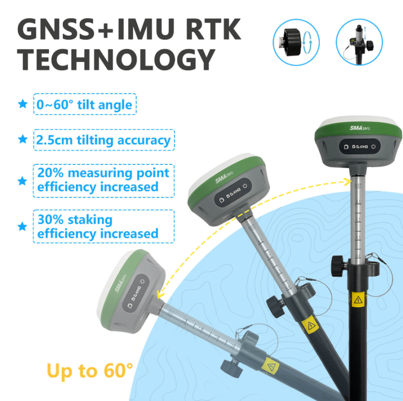
The RTK (Real-Time Kinematic) GPS technology, incorporated into the R26 V2, enhances accuracy even further by providing real-time corrections, enabling surveyors to collect instantly precise data without requiring further modifications post-survey. This advantage eliminates the need for time-consuming post-processing, thus saving both time and effort.
Moreover, the ability to track multiple satellite systems is another crucial factor for maintaining accuracy. The R26 V2 is equipped with 1408 channels, allowing it to connect to multiple satellite systems, such as GPS, GLONASS, Galileo, and BDS. This multi-frequency capacity ensures consistent precision, even in environments where satellite signals may face interference or obstructions.
2. Battery Life and Power Efficiency
When conducting fieldwork, long-lasting battery performance is a necessity. Surveyors frequently operate in outdoor conditions for extended periods, and having to pause for recharging can disrupt operations and lead to delays. The R26 V2 RTK GPS Surveying Equipment addresses this need with an integrated 10200mAh battery, offering over 14 hours of continuous use.
This extended battery duration means that the device can endure prolonged operations, even in challenging and remote areas. Whether the job involves large-scale site surveys or work in isolated regions, the R26 V2 is equipped to sustain operations for an entire day without requiring recharging. Beyond its high-capacity battery, the R26 V2 is also engineered for power efficiency, minimizing energy consumption while maintaining high levels of performance.
Its low-power design is particularly valuable when working in difficult conditions, where access to electrical power for recharging may be limited. This allows the R26 V2 to function not only as a high-performance tool but also one that efficiently adapts to the constraints of real-world survey environments.
3. Portability and Ease of Use
Surveying professionals often need to navigate difficult and uneven terrain, so having equipment that is portable and simple to operate is essential. The R26 V2 excels in this area, featuring a compact and lightweight build, making it ideal for surveyors who are frequently on the move.
Weighing only a few kilograms, the R26 V2 can be transported with ease, yet it retains the durability to withstand the demanding conditions of fieldwork. The device’s design is also equipped with intuitive software, which simplifies navigation and ensures that both experienced surveyors and novices alike can operate the equipment without complication.
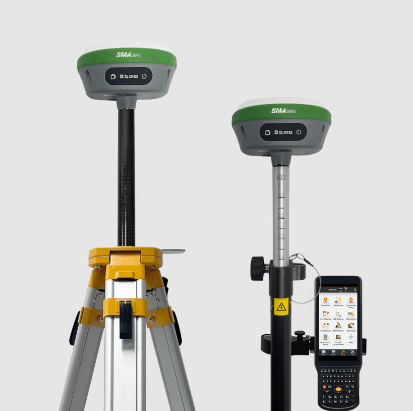
Additionally, the R26 V2 includes a handheld collector integrated with pre-installed survey software. This ensures the device is ready for immediate use without requiring complex setup procedures, allowing professionals to quickly get to work, whether they are engaged in GIS mapping, geodetic surveys, or construction-related tasks.

4. Connectivity and Wireless Capabilities
Given that many surveys take place in remote areas where traditional wired connections are impractical, the R26 V2 RTK GPS Surveying Equipment incorporates a built-in UHF wireless module, which allows for automatic switching between mobile stations and base stations. This feature enhances field mobility and ensures seamless transitions between roles, depending on the task at hand.
Moreover, the system supports the CSS (Lora) protocol, ensuring reliable communication between the rover and base stations, even in areas where infrastructure is sparse or unavailable. This capability to operate wirelessly, without sacrificing data quality or transmission reliability, is critical for maintaining efficiency in real-time surveying.
Additionally, the R26 V2 offers real-time signal tracking through its multi-system satellite compatibility, including GPS, GLONASS, Galileo, and BDS. This ensures that even in regions with limited satellite coverage, the equipment remains connected and operational, delivering consistently accurate results regardless of environmental challenges.
5. Durability and Build Quality
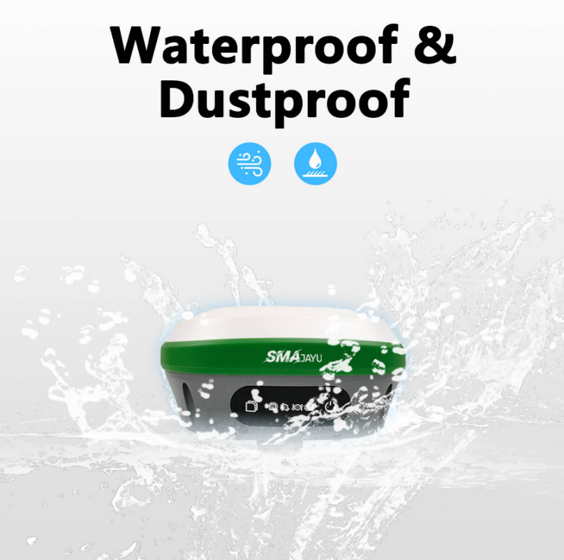
Surveying often takes place in extreme environments—whether it be rocky terrain, areas prone to heavy rain, or regions with scorching temperatures. The R26 V2 is designed to endure these conditions with its rugged and durable build, offering resistance to dust, water, and extreme weather.
In addition to its resistance to environmental factors, the R26 V2 boasts a shock-resistant design, ensuring it can withstand accidental drops or rough handling that may occur during fieldwork. The combination of durability and resilience significantly extends the equipment’s lifespan, making it a reliable companion for surveyors operating in unpredictable or harsh conditions, minimizing the likelihood of malfunction or equipment failure.
How Does RTK Survey GPS Technology Work?
The technology behind RTK (Real-Time Kinematic) GPS plays a pivotal role in delivering the exceptional precision that defines the R26 V2. But how exactly does it function?
RTK GPS technology works by employing a fixed base station in conjunction with a mobile rover station, providing real-time corrections to GPS signals. These corrections enable the system to deliver highly accurate positional data, with centimeter-level precision being the standard for RTK-based equipment like the R26 V2.

Using multi-frequency signals from global satellite constellations—such as GPS, GLONASS, Galileo, and BDS—the system utilizes advanced algorithms to refine location data, ensuring the pinpoint accuracy that is required for precision-dependent tasks such as geodetic surveys.
Conclusion
Selecting the right GPS surveying equipment can vastly enhance the precision and efficiency of your surveying projects. The R26 V2 RTK GPS Surveying Equipment from SMAJAYU distinguishes itself as an excellent option, offering superior accuracy, extended battery life, portability, and advanced connectivity features. Whether your work involves construction, engineering, GIS mapping, or geodetic surveys, this device ensures consistent and reliable performance, even under the most demanding environmental conditions.
By focusing on critical factors such as accuracy, power efficiency, ease of use, connectivity, and durability, you can be confident that your investment in GPS surveying technology will lead to faster project completions and more accurate results.


