Have You Ever Wondered How We Truly Understand Water Systems?
In a world where natural resources are as vital as ever, understanding water flow, river systems, and underground aquifers is a challenge that requires sophisticated tools and accurate data. This is where hydraulic surveys come into play. These surveys are pivotal for urban planning, agriculture, environmental monitoring, and infrastructure development. But what is the state of the hydraulic survey market today? What tools do professionals rely on, and how do they meet project needs efficiently? Let’s explore.

Global Hydraulic Survey Market: Current Status and Future Growth
The hydraulic survey market is growing steadily, reflecting its increasing significance across multiple industries. In 2023, the global market size for hydraulic survey equipment was valued at approximately $3.1 billion, and it is expected to grow at a compound annual growth rate (CAGR) of 5.75% from 2024 to 2031. By 2031, the market is projected to reach a value of around $7.34 billion. This growth is driven by several factors, such as advancements in survey technology, the increasing need for efficient water management, and global climate change, which necessitates more precise hydraulic measurements and monitoring.
Hydraulic surveys are now a cornerstone for sectors like construction, agriculture, water resources management, and environmental monitoring. This substantial growth reflects a trend where companies and governments increasingly prioritize projects involving water safety, land development, and infrastructure resilience.
Hydraulic Survey Project Needs: A Closer Look
Hydraulic survey projects can vary widely in scope and complexity, but they all share a common need: reliable, precise, and timely data. Here are some of the major requirements that arise in these projects:
Accuracy and Reliability: Survey projects require data that is both highly accurate and reliable. This is crucial for tasks like mapping water bodies, analyzing flow rates, and monitoring soil moisture.
Portability and Versatility: Surveying often occurs in remote or challenging environments. Therefore, equipment must be portable and versatile to adapt to various terrains.
Compatibility with Other Systems: Many hydraulic surveys involve integration with Geographic Information Systems (GIS) or are part of broader surveying and engineering tasks. The need for seamless compatibility with other data systems is key for effective project execution.
Real-Time Data and Connectivity: Hydraulic survey projects benefit immensely from real-time data collection and transmission. With modern systems, surveyors expect built-in connectivity like Bluetooth, radio, and real-time communication to facilitate seamless workflows.
Technological Solutions: Built for the Modern Hydraulic Surveyor
Hydraulic survey technology has seen remarkable innovation in recent years, particularly in its ability to deliver on project needs efficiently and effectively. One of the key players in providing advanced hydraulic survey solutions is SMAJAYU.

SMAJAYU's Solutions: Built-In Connectivity and Versatility
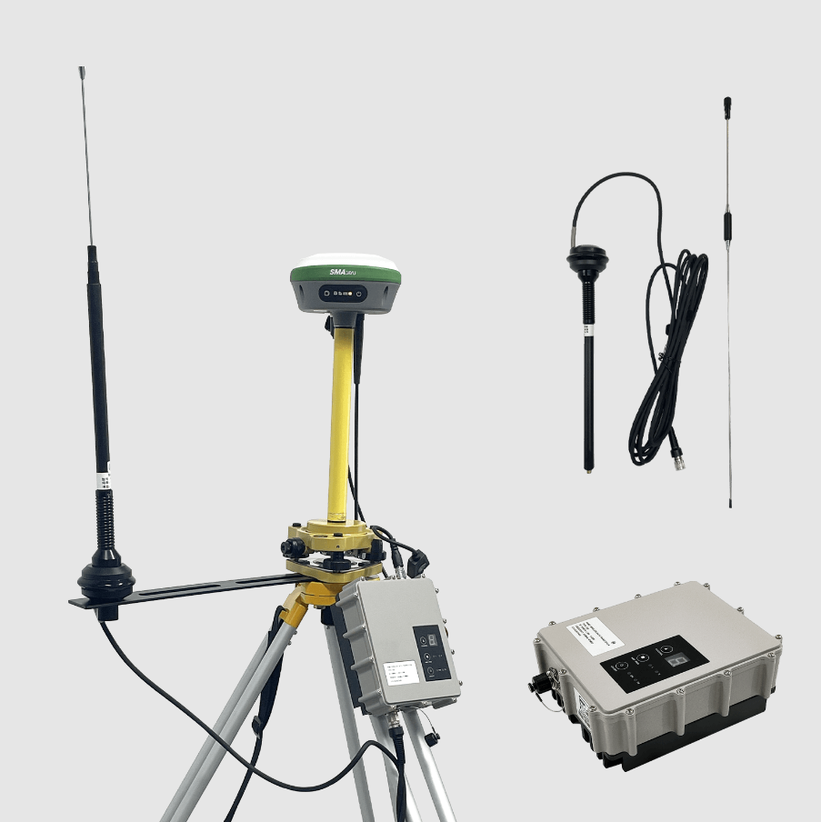
SMAJAYU offers a range of hydraulic survey equipment tailored to meet the diverse needs of surveying professionals. The equipment is built with advanced technology such as built-in Bluetooth, radio, storage, positioning, inertial navigation, and antenna modules. These features are vital for a successful hydraulic survey as they provide an all-in-one solution for data collection, positioning, and communication. Here’s a closer look at some of SMAJAYU’s standout products:
SMA26 GNSS Surveying System: High Precision and Adaptability
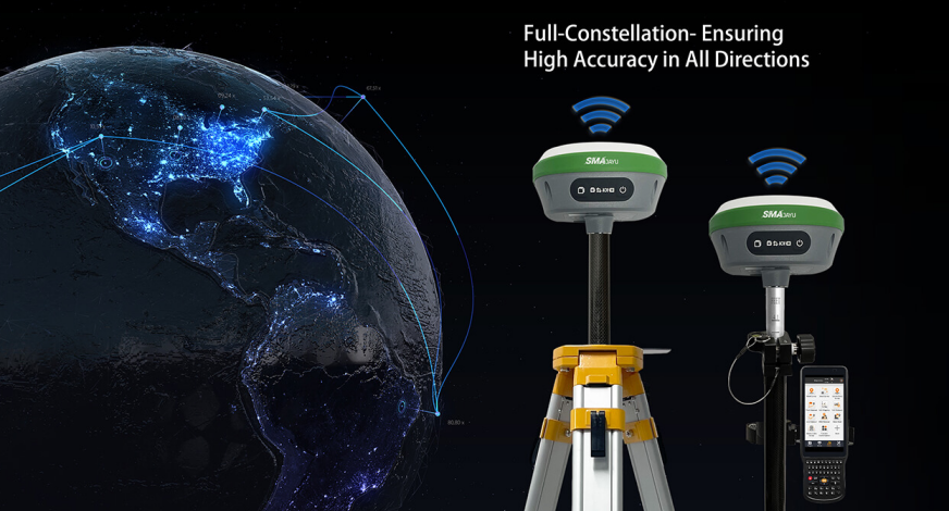
One of the star products in SMAJAYU’s lineup is the SMA26 GNSS Surveying System. This system consists of the SMA26 rover, a base station, and a collector with surveying software. It offers a unique combination of cutting-edge technology features that make it perfect for hydraulic surveys and more.
Versatile Functionality: The SMA26 can serve as either a mobile station or a base station, which means it can adapt to the specific needs of different projects. Whether surveyors need mobility or a fixed reference point, the SMA26 provides the necessary flexibility.
Portability and Precision: With a small size, low power consumption, and easy portability, the SMA26 is suitable for rugged environments where bulky equipment could hinder productivity. It also boasts a high-precision GNSS receiver, which allows surveyors to gather detailed measurements with utmost accuracy.
Advanced Features for Efficiency: The SMA26 includes an embedded intelligent system supporting voice commands, an intelligent web page platform WEBUI, and a device self-test. These functions significantly improve efficiency during surveys, enabling rapid adjustments, testing, and system setup on-site.
Custom Solutions for Varied Industry Needs
Different industries require specialized surveying solutions that cater to unique demands. The SMA26 GNSS Surveying System provides a complete, integrated solution for hydraulic surveys and related fields:
Mechanical Control and Precision Agriculture: In agriculture, efficient water management is crucial for ensuring crop health and maximizing yields. The SMA26 system helps farmers plan and execute irrigation by providing accurate land gradient measurements and helping to manage water flow precisely.
Geographical Information and Water Surveying: Projects involving river mapping, dam safety inspections, or watershed assessments require accurate GNSS data to provide insights into water patterns. The SMA26 system, with its compatibility across constellations (including Beidou-3) and capability to search 40+ satellites, ensures precise positioning regardless of the complexity of the environment.
Engineering and Mine Surveying: Engineering projects like road construction, tunneling, and mining require detailed land surveys. The SMA26 system helps engineers gather the information they need, whether above or below the surface, using reliable and precise GNSS data.
Drone Surveys and Aerial Photography: In modern surveying, drones play an increasingly critical role, providing comprehensive overviews from above. The SMA26 system integrates seamlessly with drone technology, ensuring that aerial data is geo-referenced with accuracy. This feature is particularly valuable in areas such as remote topographical surveys and environmental studies.
SMAJAYU: A Trusted Partner in Hydraulic Surveys
Choosing the right equipment supplier can make or break a hydraulic survey project, and SMAJAYU has positioned itself as a trusted partner in this field. Their focus is on delivering reliable, high-precision survey solutions that leverage the latest technology, ensuring users have what they need to succeed.

Built-In Modules: One Device, Many Features
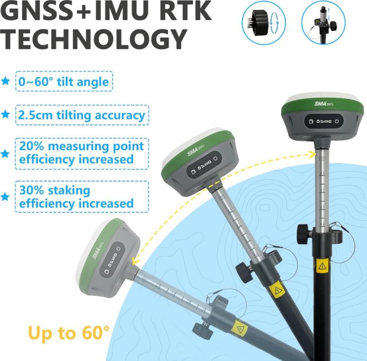
With built-in modules like Bluetooth, radio, and positioning, the SMA26 GNSS system takes much of the hassle out of the surveying process. These built-in capabilities mean surveyors can focus on their core task—collecting accurate data—instead of managing a tangled web of additional devices and peripherals. From inertial navigation that enhances positioning accuracy to integrated antennas that improve signal reliability, every feature is designed with the needs of modern hydraulic surveying in mind.
SMA26 RTK GNSS Receiver: The Heart of the System
At the heart of the SMA26 GNSS Surveying System is the SMA26 RTK GNSS receiver. This device is capable of receiving satellite signals across all constellations and frequency points, including Beidou-3. The ability to search for 40+ satellites simultaneously ensures high reliability and positioning accuracy even in challenging environments, such as heavily forested areas or urban canyons where satellite visibility can be limited.
What the Future Holds: Moving Forward with Hydraulic Surveys
As the demand for precise and efficient hydraulic surveys grows, the role of innovative technologies will only become more critical. Companies like SMAJAYU are stepping up to meet this challenge with advanced solutions designed for versatility, precision, and ease of use.
By 2028, with the market expected to hit $5.8 billion, the widespread adoption of GNSS systems, like the SMA26, will likely redefine what’s possible in surveying. Real-time data, integrated communication modules, and powerful built-in tools are already pushing boundaries, helping surveyors and engineers across industries to deliver better, more reliable insights into the world’s water systems.
Final Thoughts: Why Choose SMAJAYU for Your Hydraulic Survey Needs?
If you are involved in surveying work (whether it is water resources, construction projects, precision agriculture or environmental research). You’ll know that having the right equipment is crucial. Hydraulic surveying requires equipment that is more than just accurate. It is also multi-functional and reliable, and can meet the strict requirements of different environments.
SMAJAYU provides the technology that meets these needs. With products like the SMA26 GNSS Surveying System, users have access to cutting-edge technology that simplifies the surveying process, enhances accuracy, and delivers results efficiently. With its built-in versatility and advanced features, the SMA26 system can help unlock the full potential of hydraulic surveys and propel industries forward in a world increasingly shaped by precision data and real-time decision-making.
Whether it's surveying a river, managing an irrigation system, or mapping underground water resources, SMAJAYU's solutions stand ready to equip professionals with the tools they need to succeed.


