Have you ever wondered how engineers ensure the accuracy of land measurements in large construction projects, or how they can achieve precision even in challenging terrains? This is where Land Engineering & Surveying come into play—a field that is growing in demand and scope due to advancements in technology and the rising complexity of modern infrastructure projects.

From mapping out urban developments to ensuring that environmental impact is minimized, the need for accurate and efficient land surveying is undeniable. And with cutting-edge technology like the SMA20 RTK GNSS Receiver, companies can achieve precision and reliability in their surveying projects, even in harsh conditions.
The Importance of Land Engineering & Surveying
Why Are Land Surveys Critical?
Land Engineering & Surveying is the foundation of most construction and development projects. Without proper surveys, project managers run the risk of misaligned structures, property disputes, and even environmental damage. A survey determines property boundaries, topographical details, and ensures that all legal regulations are followed before breaking ground.
In construction, even a few centimeters of error can lead to significant financial loss. For instance, an improperly placed foundation might lead to a building being out of compliance with local zoning laws or cause structural issues down the road. Surveys ensure that these kinds of mistakes are avoided by providing precise data about the land.
Challenges of Traditional Surveying Methods
Traditional land surveying techniques often require cumbersome equipment and extensive time on site. Surveyors had to manually level equipment, make multiple adjustments, and ensure measurements were correct. Moreover, harsh environments—such as uneven terrain, urban settings with interference, or areas with poor satellite signals—further complicated the task.
As land projects have grown in complexity and scale, traditional methods have become less efficient. To meet the modern demands of land engineering, advanced technology has stepped in, offering faster, more accurate, and reliable solutions.
The Rising Need for Advanced Surveying Technology
The need for accurate land surveying extends beyond construction. Industries like real estate, environmental management, urban planning, and even disaster recovery rely on precise measurements to make informed decisions. With the increase in population and urbanization, accurate surveying is critical to managing land resources efficiently and sustainably.
Land Engineering & Surveying Technological advancements like GNSS (Global Navigation Satellite System) and RTK (Real-Time Kinematic) surveying have transformed how data is collected, reducing the time spent in the field and enhancing the accuracy of the results.
The Solution: SMA20 RTK GNSS Receiver
Introducing the SMA20 RTK GNSS Receiver
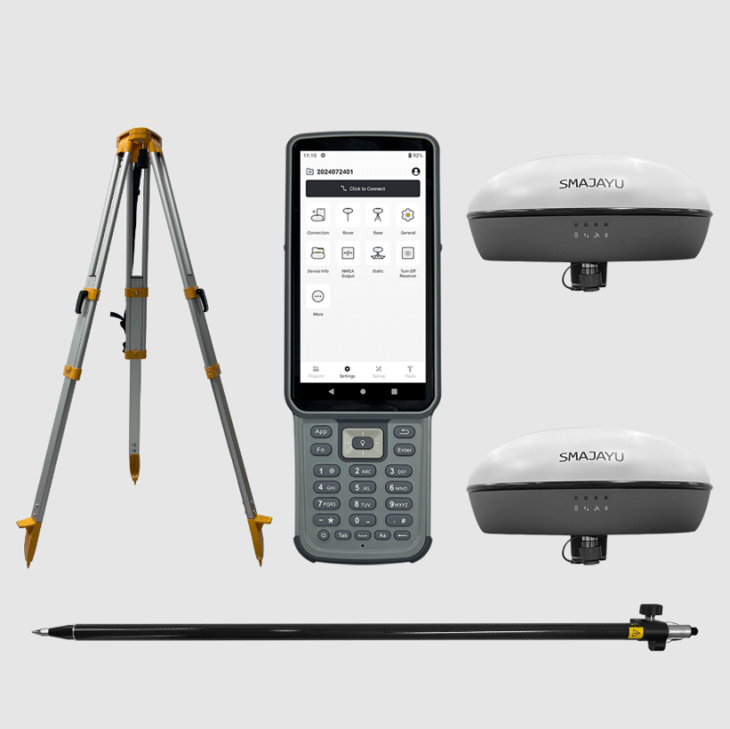
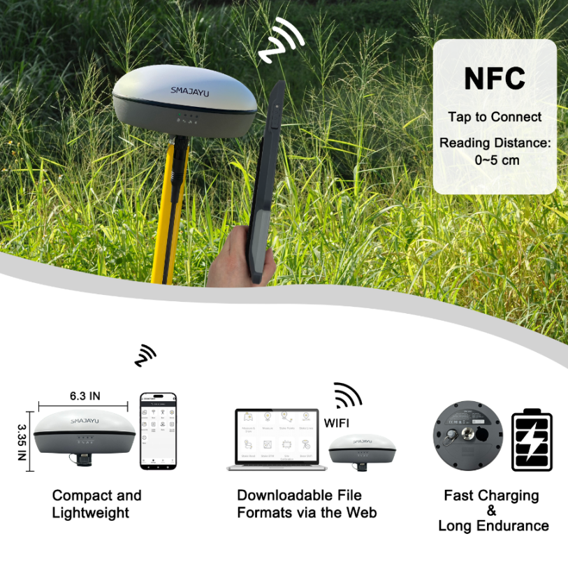
For companies seeking accurate, efficient, and reliable Land Engineering & Surveying solutions, the SMA20 RTK GNSS Receiver offers the perfect solution. Developed by SMAJAYU, this device is a versatile and lightweight GNSS RTK receiver designed to deliver precise positioning data, even in the harshest environments. Priced at $2,999.00, it provides an affordable yet powerful option for land engineers and surveyors.

One of the key features of the SMA20 RTK is its global signal coverage, which means it can provide accurate data in areas where traditional GPS systems might struggle. Whether you’re working in a remote region or an urban jungle, the SMA20 RTK ensures reliable measurements.
How the SMA20 RTK Works
The SMA20 RTK GNSS Receiver integrates an Inertial Measurement Unit (IMU), which sets it apart from many other surveying devices. This IMU allows for tilt measurement, meaning the surveyor no longer needs to level the bubble manually when measuring. In the past, surveyors had to ensure their equipment was perfectly aligned to gather accurate data. The SMA20 RTK eliminates this step, offering greater convenience and faster workflows.
The device combines data from both GNSS satellites and the IMU to ensure that the position is accurate to within 3 cm, even with a tilt angle of up to 60 degrees. This kind of precision is invaluable for projects where every millimeter counts. Whether you’re surveying sloped land or measuring uneven terrain, the SMA20 RTK simplifies the task without sacrificing accuracy.
Advantages of Using the SMA20 RTK GNSS Receiver
Increased Efficiency: By eliminating the need for manual leveling, the SMA20 RTK allows surveyors to complete their tasks much faster. No more fiddling with tripods and adjusting equipment—just point, measure, and move on. This makes it especially valuable for large-scale projects where time is money.
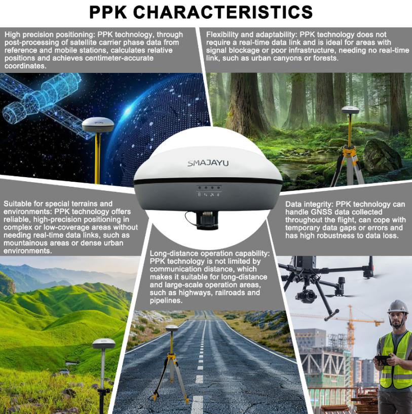
High Precision in Challenging Conditions: The integration of GNSS and IMU allows the receiver to maintain its accuracy even in challenging environments, including dense urban areas, forests, and mountainous terrain. With a 3 cm accuracy at a tilt of up to 60 degrees, it performs where other devices might fail.
Global Signal Coverage: Thanks to its global signal coverage, the SMA20 RTK can be used anywhere in the world, making it ideal for international projects. Surveyors don’t have to worry about losing signal or data quality, even in remote locations.
Applications of the SMA20 RTK in Land Engineering
Construction and Infrastructure Projects
In the construction industry, precision is critical from the initial design stages to the final inspection. The SMA20 RTK GNSS Receiver can be used to mark out boundaries, lay out foundations, and ensure that every part of the project aligns with the architectural plans. With its high accuracy and time-saving features, it helps construction teams work faster while reducing the margin of error.

Real Estate Development
Real estate developers often rely on accurate Land Engineering & Surveying to determine the best use of property and avoid encroachments. The SMA20 RTK can assist in marking property lines, ensuring that developments remain within legal boundaries. Additionally, it allows for the creation of topographical maps, which help developers understand the landscape and make informed decisions on where to build.
Environmental and Disaster Recovery Projects
Accurate land surveys are essential for managing natural resources and recovering from environmental disasters. Surveying floodplains, assessing erosion, or managing forested areas require precise data, and the SMA20 RTK excels in these challenging environments. The global signal coverage also makes it a valuable tool for international disaster response efforts, where quick and reliable data is crucial.
The Future of Land Engineering and Surveying
Growing Demand for Smart Surveying Solutions
As the world becomes more interconnected and urbanized, the demand for smart surveying solutions will continue to grow. Advanced devices like the SMA20 RTK will become increasingly important, as they can keep up with the complexities of modern projects. With the rise of smart cities, renewable energy installations, and sustainable construction practices, the need for precise, fast, and flexible surveying technology is greater than ever.
The Role of Automation and AI in Surveying
Looking ahead, we can expect even greater integration of automation and AI in land engineering. Drones equipped with GNSS receivers like the SMA20 RTK are already being used for large-scale mapping projects. AI could further enhance data processing, allowing surveyors to generate actionable insights faster than ever before. With these advancements, land engineers will be able to tackle projects that were previously too complex or time-consuming.
Conclusion: SMA20 RTK as a Game Changer
The SMA20 RTK GNSS Receiver from SMAJAYU is not just a tool for land engineers and surveyors—it’s a game changer. By combining the power of GNSS and IMU technology, it allows for faster, more accurate, and more efficient surveys in even the harshest environments. Whether it’s construction, real estate, or environmental management, the SMA20 RTK provides a reliable Land Engineering & Surveying solution that will keep pace with the growing demands of modern land engineering.
As land surveying continues to evolve, devices like the SMA20 RTK will play an essential role in shaping the future of infrastructure and development. For companies looking to stay ahead of the curve, investing in advanced surveying technology is no longer optional—it’s a necessity.


