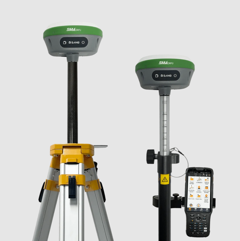
What is R26 Measurement System? The R26 Measurement System is a cutting-edge tool designed to revolutionize the field of surveying, particularly within the agriculture industry. This system, developed by SMAJAYU, employs advanced Real-Time Kinematic (RTK) GPS technology to provide precise, instantaneous measurements and data, making it an invaluable asset for surveyors and agricultural professionals alike.

Features of the R26 Measurement System
The R26 Measurement System is equipped with several innovative features that enhance its performance and usability:
Advanced RTK GPS Technology
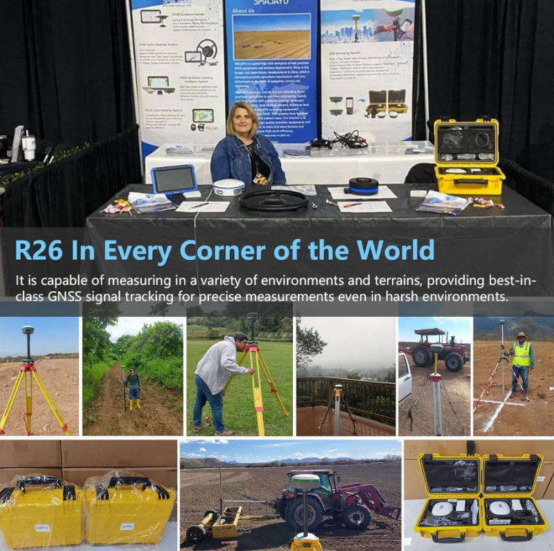
The cornerstone of the R26 Measurement System is its utilization of RTK GPS technology. This allows for real-time data acquisition with exceptional accuracy, typically within 1 centimeter. By leveraging dual-frequency capabilities and multiple satellite systems, including BDS, GPS, GLONASS, Galileo, and QZSS, the R26 ensures reliable and precise measurements even in challenging environments.
Long Battery Life and High Capacity
One of the standout features of the R26 is its robust battery life. With a built-in battery capacity of 10,200mAh, the system can operate continuously for over 14 hours. This long battery life ensures that surveyors can conduct extensive fieldwork without interruptions, making the R26 an ideal choice for lengthy and demanding surveying tasks.
Built-in UHF Wireless and Signal Tracking
The R26 Measurement System comes with an integrated low-power transceiver and wireless module, enabling automatic switching between mobile and base stations. Additionally, it features advanced signal tracking capabilities with 1408 channels, based on the NebulasIV platform. This ensures comprehensive coverage and reliability in various field conditions.
Precision and Accuracy in Industrial Applications
The Importance of Accurate Measurements
In industries such as construction, agriculture, and mining, accurate measurements are critical. Errors in data can lead to costly mistakes, safety hazards, and inefficiencies. The R26 Measurement System utilizes Real-Time Kinematic (RTK) GPS technology to deliver centimeter-level accuracy, ensuring that measurements are reliable and precise.
Advanced RTK GPS Technology
The R26 Measurement System's RTK GPS capabilities allow for real-time data acquisition, eliminating the need for post-processing. This feature is particularly beneficial in dynamic environments where conditions can change rapidly, requiring immediate data analysis and decision-making.
Reducing Human Error
Manual measurements are prone to human error, which can compromise the integrity of data. The R26 automates the measurement process, significantly reducing the risk of inaccuracies caused by human mistakes. This automation ensures consistency and reliability, essential for maintaining high standards in industrial projects.
Enhancing Efficiency and Productivity
Streamlining Operations
Industries are constantly seeking ways to streamline operations and improve efficiency. The R26 Measurement System facilitates this by providing real-time data that can be used immediately. This capability allows for quick adjustments and continuous monitoring, optimizing workflow and reducing downtime.

Time-Saving Benefits
The traditional surveying methods often require multiple visits to the site and extensive post-processing of data. The R26 Measurement System, with its real-time capabilities, drastically reduces the time needed for surveying tasks. This time-saving benefit translates into cost savings and allows projects to be completed faster.
Integrating with Existing Systems
The R26 is designed to integrate seamlessly with existing industrial systems. Its compatibility with various software and hardware platforms ensures that it can be incorporated into current workflows without the need for significant modifications. This flexibility makes it an attractive solution for industries looking to upgrade their measurement capabilities without disrupting their operations.
How to Use the R26 Measurement System
Utilizing the R26 Measurement System involves a few straightforward steps to set up and begin surveying:
Step 1: Connecting the Collector to the Base
To start, connect the collector device with one R26 unit via Bluetooth, designating it as the base. This connection is crucial for establishing the initial reference point for your measurements.
Step 2: Initializing the Base
Wait for approximately three minutes. This step is essential as it allows the base to initialize and stabilize, ensuring accurate data transmission and reception.
Step 3: Configuring the Rover
After the initial setup, disconnect the collector from the base and connect it to another R26 unit. Set this second unit up as a rover. Ensure that the radio protocol and channel on both the rover and the base are the same until a fixed signal is displayed. The R26 V2 model selects the 'CCS' protocol by default, which simplifies this configuration process.
Step 4: Starting the Survey
Once the setup is complete and the fixed signal is confirmed, you can proceed with parameter settings and begin your surveying job. The system's real-time capabilities mean that you can collect and analyze data on the spot, significantly enhancing efficiency and accuracy.
The Role of the R26 Measurement System in Agriculture
The R26 Measurement System plays a pivotal role in the agriculture industry, offering numerous benefits that enhance productivity and precision.

Enhancing Agricultural Surveys
In agriculture, precise measurements are crucial for tasks such as land mapping, irrigation planning, and crop monitoring. The R26's RTK GPS technology provides highly accurate data, enabling farmers and agronomists to make informed decisions and optimize their operations.
Improving Efficiency and Reducing Costs
By offering real-time data and eliminating the need for post-processing, the R26 Measurement System significantly improves the efficiency of agricultural surveys. This reduction in time and labor costs allows farmers to allocate resources more effectively and focus on other critical aspects of their operations.
Supporting Sustainable Practices
Accurate data from the R26 can help farmers implement sustainable practices by optimizing resource use and minimizing waste. For instance, precise land measurements can aid in efficient water management, reducing water consumption and promoting sustainable agriculture.
Technology in Surveying: Real-Time Kinematic (RTK) GPS
RTK GPS technology represents the forefront of innovation in the surveying industry. It offers several advantages that make it an indispensable tool for modern surveyors.
How RTK Survey GPS Works
RTK GPS systems operate by using a base station and a rover to measure the carrier phase of satellite signals. The base station receives signals from multiple satellites and sends correction data to the rover, which adjusts its position accordingly. This process allows for centimeter-level accuracy, making RTK GPS ideal for high-precision surveying tasks.
Advantages of RTK GPS
One of the main advantages of RTK GPS is its ability to provide real-time data. This instant feedback allows surveyors to make on-the-spot adjustments and verify the accuracy of their measurements without the need for post-processing. Additionally, the use of multiple satellite systems ensures reliable performance even in areas with limited satellite visibility.

Applications in Various Fields
Beyond agriculture, RTK GPS technology is used in various fields, including construction, mining, and environmental monitoring. Its precision and efficiency make it a valuable tool for any industry that requires accurate geospatial data.
Conclusion
The R26 Measurement System by SMAJAYU is a powerful tool that leverages advanced RTK GPS technology to provide precise, real-time data for surveying applications. Its robust features, ease of use, and significant benefits in efficiency and accuracy make it an invaluable asset, particularly in the agriculture industry. As technology continues to advance, tools like the R26 will play an increasingly important role in shaping the future of surveying and agriculture, enabling professionals to work smarter and more sustainably.


