The R26 Survey Vehicle, supplied by SMAJAYU, represents a significant advancement in the field of surveying and geodetic measurements. This cutting-edge system incorporates the R26 V2 RTK GNSS Survey Equipment, designed to deliver unparalleled accuracy and efficiency in various surveying applications. Equipped with advanced technology, including a rover, base station, and handheld collector, the R26 Survey Vehicle is poised to transform how professionals approach land surveying, engineering, and geographic information system (GIS) projects.
Components of the R26 Survey Vehicle
The R26 V2 RTK GNSS Survey Equipment
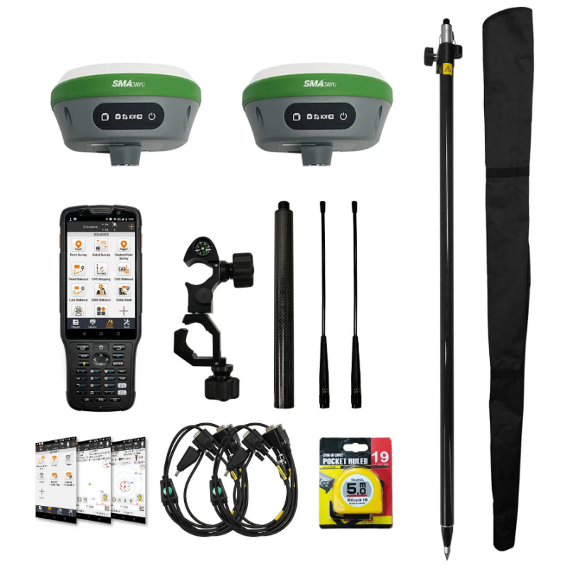
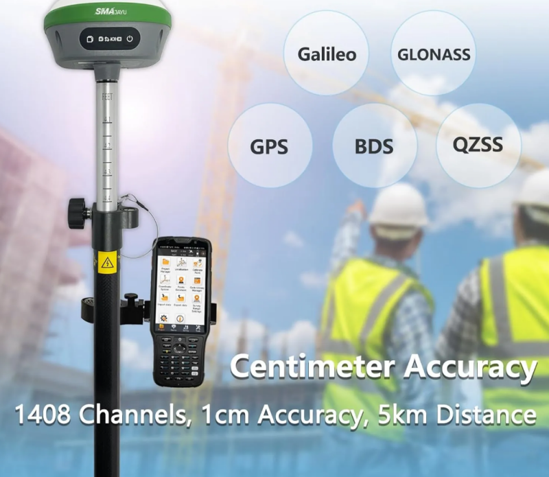
At the heart of the R26 Survey Vehicle lies the R26 V2 RTK GNSS Survey Equipment. This sophisticated system includes a rover, base station, and a handheld collector loaded with advanced surveying software. The R26 V2 is certified by NOAA and boasts 1408 channels, ensuring high precision and reliability in data collection. The equipment's capability to achieve 1cm accuracy sets a new benchmark in the industry, making it ideal for detailed and demanding surveying tasks.

The GNSS IMU RTK GPS Surveying System
The R26 V2 GNSS IMU RTK GPS Surveying System integrates a Global Navigation Satellite System (GNSS) receiver with an Inertial Measurement Unit (IMU). This combination enhances the system's ability to provide accurate and stable positioning, even in challenging environments. The GNSS receiver supports multiple satellite constellations, including GPS, GLONASS, and Galileo, ensuring robust performance in various locations and conditions.
The GPS Poles for Land Surveying
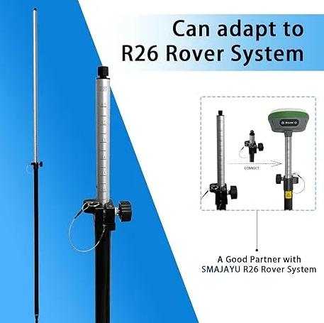
The R26 Survey Vehicle includes specialized GPS poles designed for land surveying. These poles feature a double scale, displaying measurements in both meters and feet, which adds versatility and convenience for users working in different regions or with varying measurement preferences. The sturdy construction of the poles ensures durability and stability during field operations, contributing to the overall accuracy of the surveying process.
How the R26 Survey Vehicle Works
Setting Up the Base Station
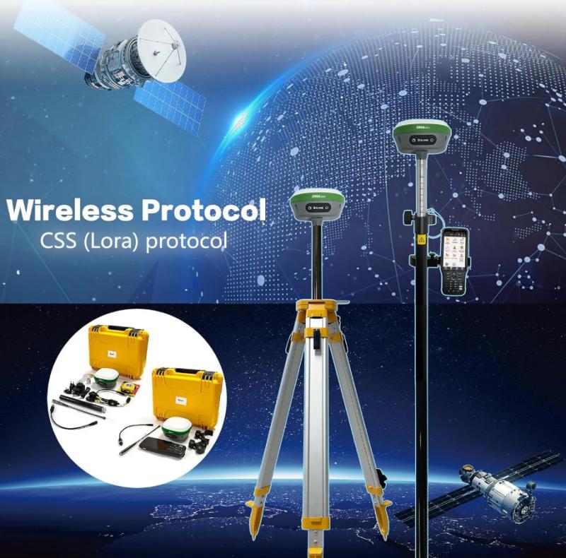
The first step in utilizing the R26 Survey Vehicle involves setting up the base station. Users need to connect the handheld collector to one of the R26 units via Bluetooth (BT) and configure it as the base station. This process takes approximately three minutes and is crucial for establishing a stable reference point for subsequent measurements.
Configuring the Rover
After setting up the base station, the next step is to configure the rover. This involves disconnecting the collector from the base station and reconnecting it to the second R26 unit. The rover is then set up by ensuring that it uses the same wireless protocol (CCS) and channel as the base station. Once the connection is established and fixed, users can proceed with parameter settings and begin the surveying job.
Conducting Surveying Operations
With the base station and rover configured, the R26 Survey Vehicle is ready for operation. The system's high precision, enabled by its advanced GNSS and IMU technology, allows users to conduct detailed and accurate surveys. Whether for construction layout, geodetic measurements, or mapping engineering, the R26 Survey Vehicle delivers reliable data essential for informed decision-making.
Applications of the R26 Survey Vehicle
Surveying and Mapping Engineering
The R26 Survey Vehicle is highly versatile and can be employed in a wide range of surveying and mapping engineering applications. Its ability to provide centimeter-level accuracy makes it an invaluable tool for creating detailed maps and models. This precision is particularly beneficial in urban planning, construction projects, and infrastructure development, where accurate spatial data is critical.

Geographic Information Systems (GIS)
Geographic Information Systems (GIS) benefit significantly from the R26 Survey Vehicle's capabilities. The system's ability to integrate with various satellite constellations ensures comprehensive and accurate data collection, which is essential for creating and maintaining GIS databases. Professionals in fields such as environmental science, urban planning, and resource management can leverage the R26 Survey Vehicle to enhance their GIS projects.
Engineering and Mine Surveying
In the fields of engineering and mine surveying, the R26 Survey Vehicle stands out as a reliable and efficient tool. Its robust performance in harsh and complex environments makes it suitable for challenging projects. Whether surveying a construction site or mapping a mining area, the R26 Survey Vehicle provides the precision and reliability needed to ensure successful project outcomes.

Advantages of Using the R26 Survey Vehicle
High Precision and Accuracy
One of the primary reasons to use the R26 Survey Vehicle is its exceptional precision and accuracy. The system's ability to achieve 1cm accuracy ensures that users can rely on the data collected for critical decision-making processes. This level of precision is particularly important in applications where even minor errors can have significant consequences.
Advanced Technology Integration
The R26 Survey Vehicle incorporates a range of advanced technologies to meet various measurement needs. Built-in Bluetooth, wireless communication, storage, positioning, and inertial navigation modules enhance the system's functionality and ease of use. The low-power transceiver integrated wireless module and IMU further contribute to the system's efficiency and reliability.
User-Friendly Design
Despite its advanced capabilities, the R26 Survey Vehicle is designed to be user-friendly. The handheld collector comes with professional surveying software that provides clear instructions and simplifies the setup process. The system's compact size and low power consumption make it easy to carry and operate, allowing users to focus on their surveying tasks without unnecessary complications.
The Role of RTK Surveying Software
Permanent Software Validity
The RTK surveying software installed on the handheld collector is a crucial component of the R26 Survey Vehicle. One of its standout features is permanent validity, ensuring that users have continuous access to the software without worrying about expiration dates or additional costs. This feature provides long-term value and reliability for users.

Regular Software Updates
To keep pace with technological advancements and evolving user needs, the RTK surveying software is regularly updated. Users can easily download the latest software versions from the supplier's website, ensuring they always have access to the most up-to-date features and improvements. This commitment to ongoing software development underscores the supplier's dedication to customer satisfaction and system performance.
Comprehensive Technical Support
SMAJAYU offers extensive technical support for the R26 Survey Vehicle. Users can contact the supplier's technical team for assistance to ensure the equipment operates at its best. The availability of a PDF electronic manual and instructional videos on platforms like YouTube further enhances the support resources available to users, making it easier to troubleshoot and optimize the system.
Conclusion
The R26 Survey Vehicle, supplied by SMAJAYU, is a state-of-the-art tool that revolutionizes the field of surveying. With its advanced RTK GNSS technology, high precision, and user-friendly design, it is an invaluable asset for professionals in various surveying and engineering disciplines. Whether for construction, GIS, or mining projects, the R26 Survey Vehicle delivers reliable and accurate data, enabling users to achieve their project goals with confidence. With ongoing software updates and comprehensive technical support, the R26 Survey Vehicle remains at the forefront of surveying technology, ready to meet the challenges of today's dynamic and demanding environments.


