


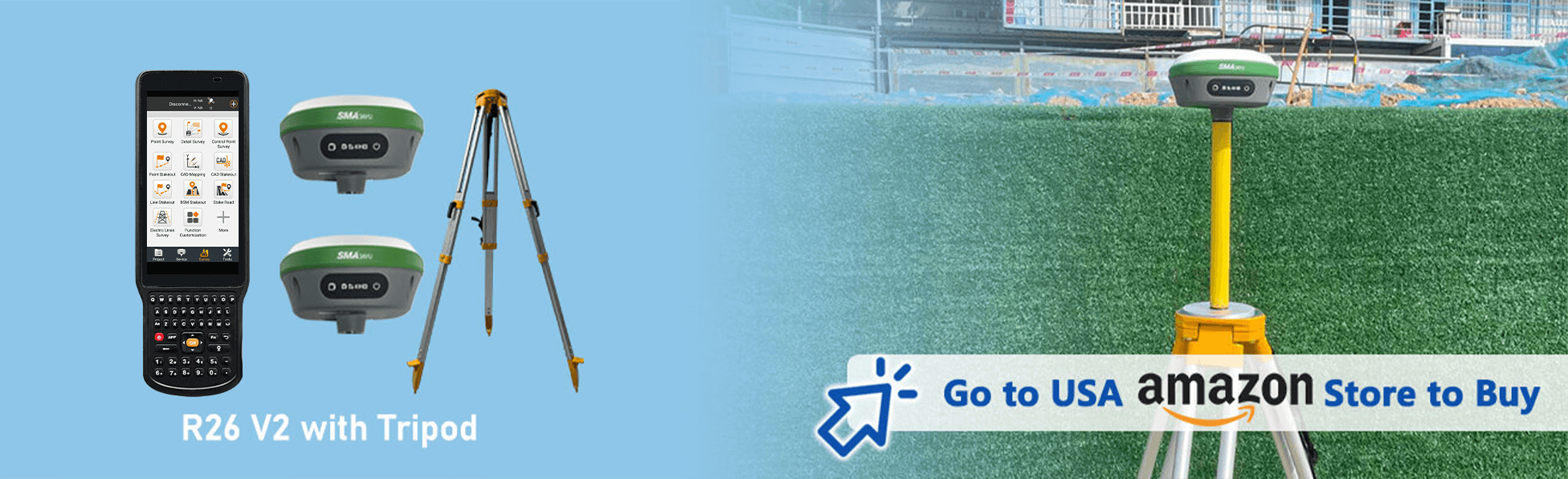
R26 V2 RTK+tripod
$2,886.00
Stars,100% Recommend
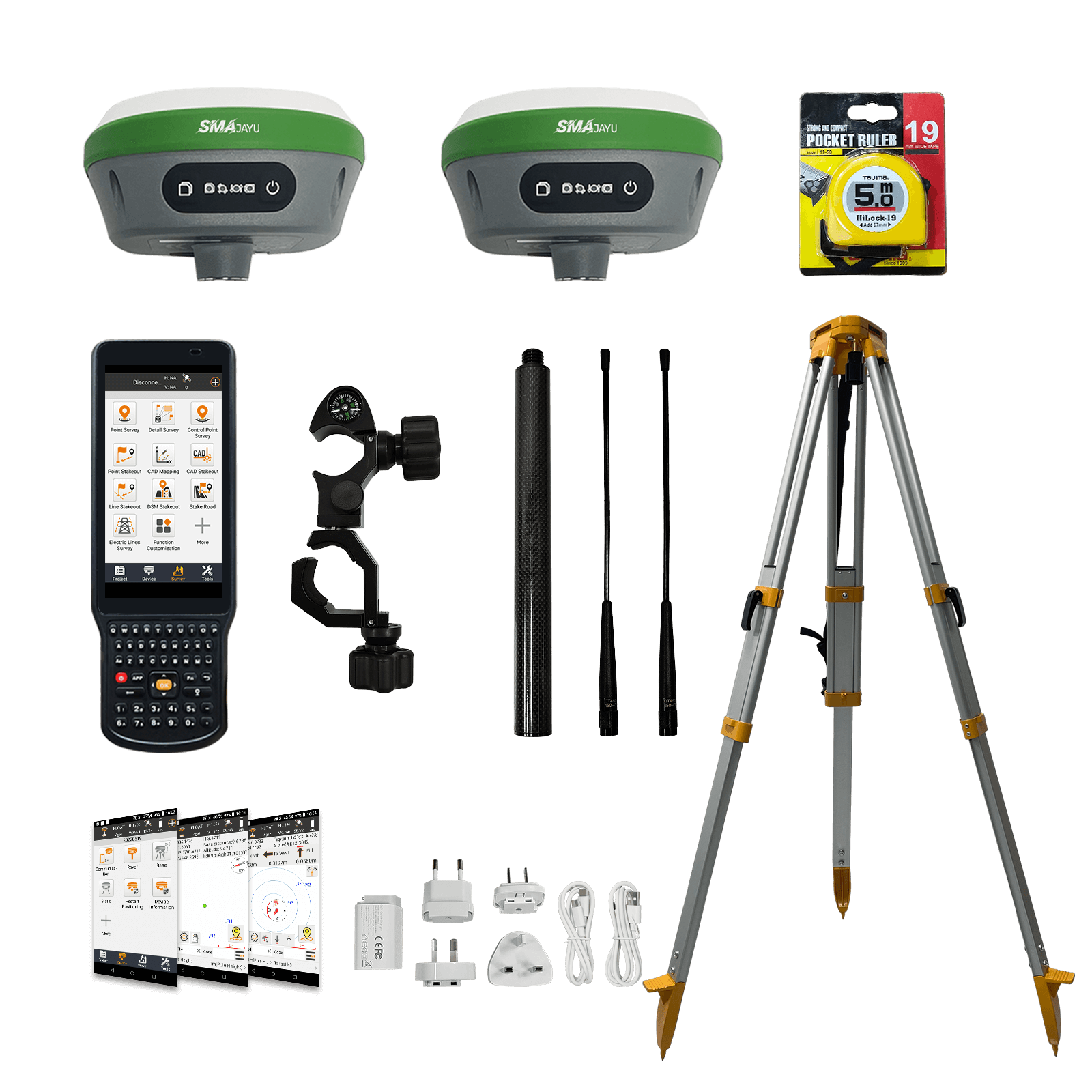
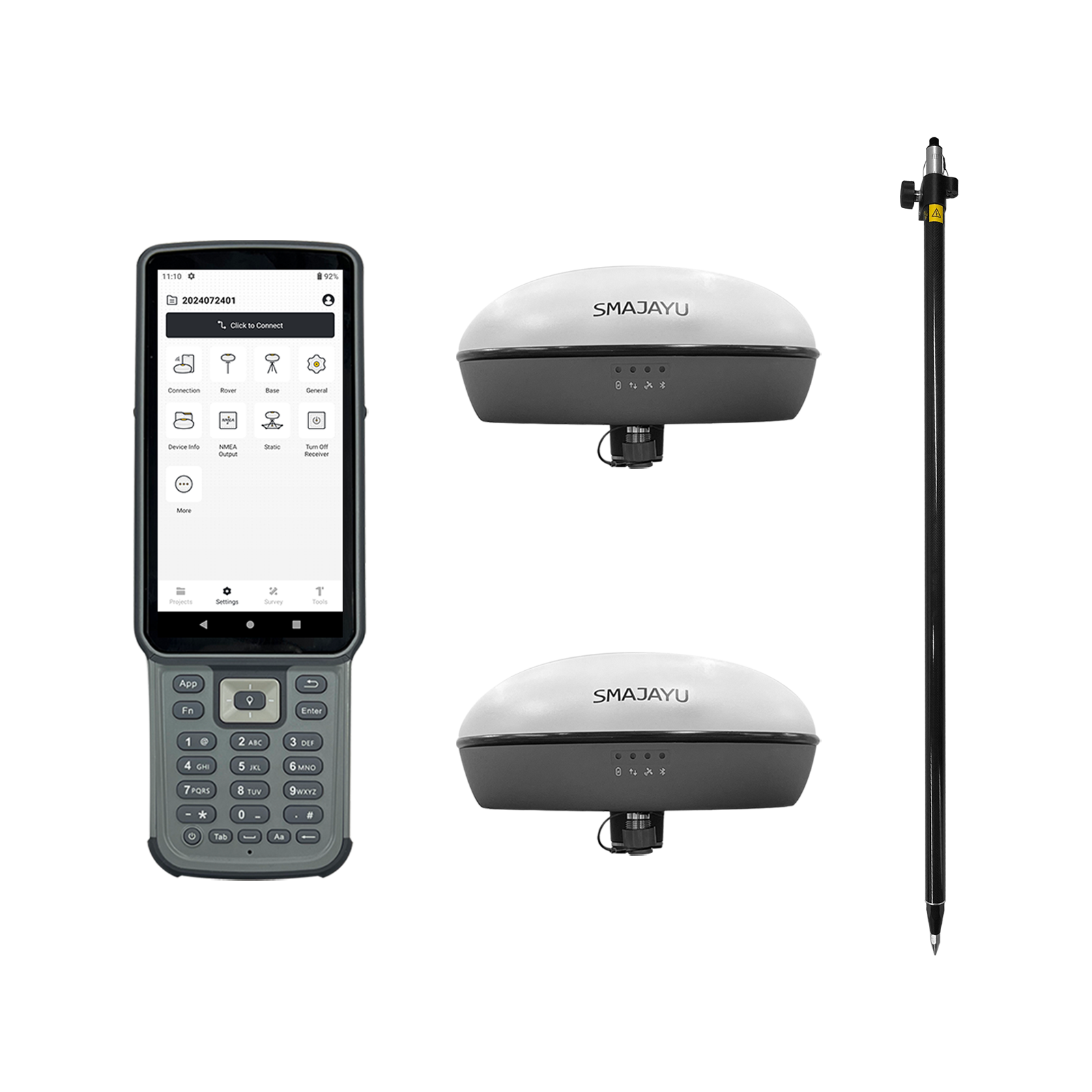
R26 V2 RTK GNSS Survey Equipment (include Tripod)
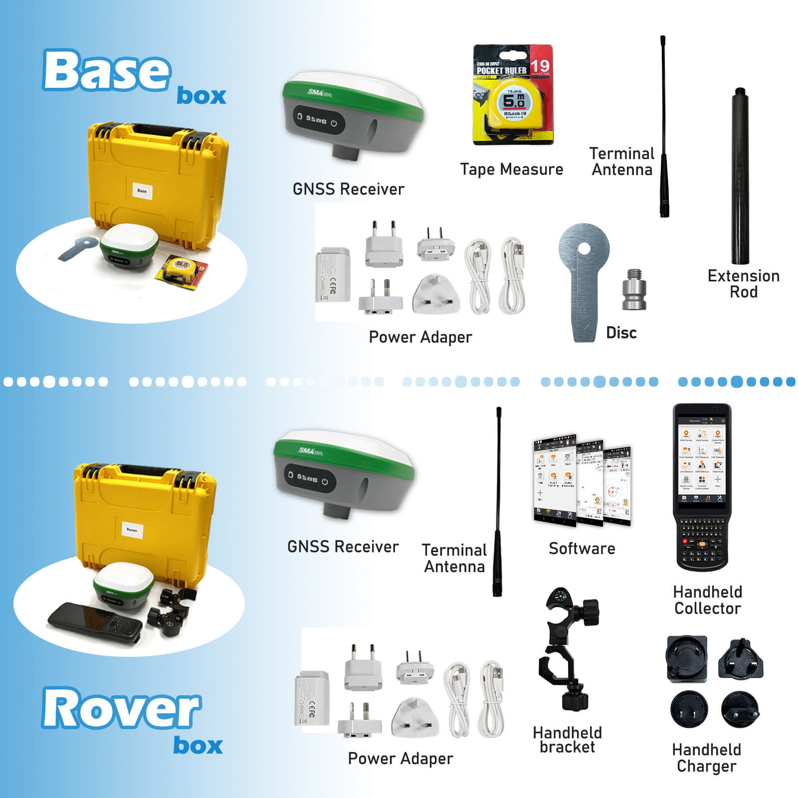
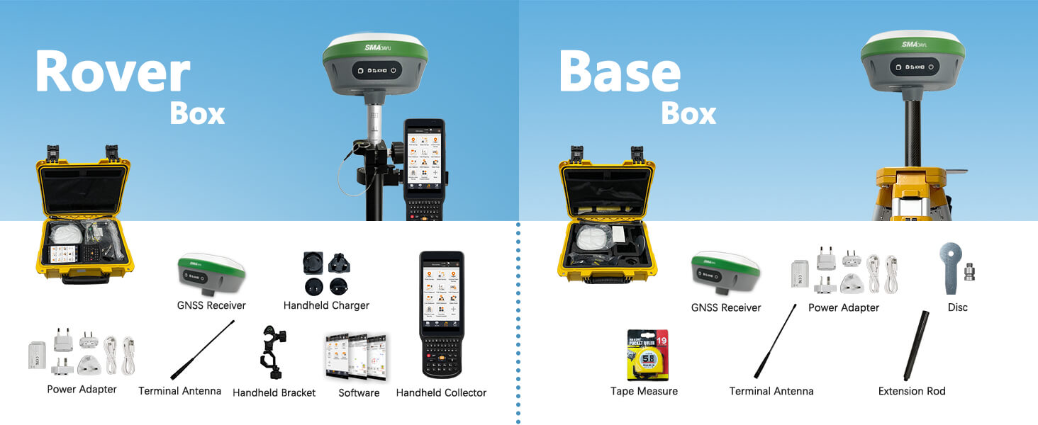
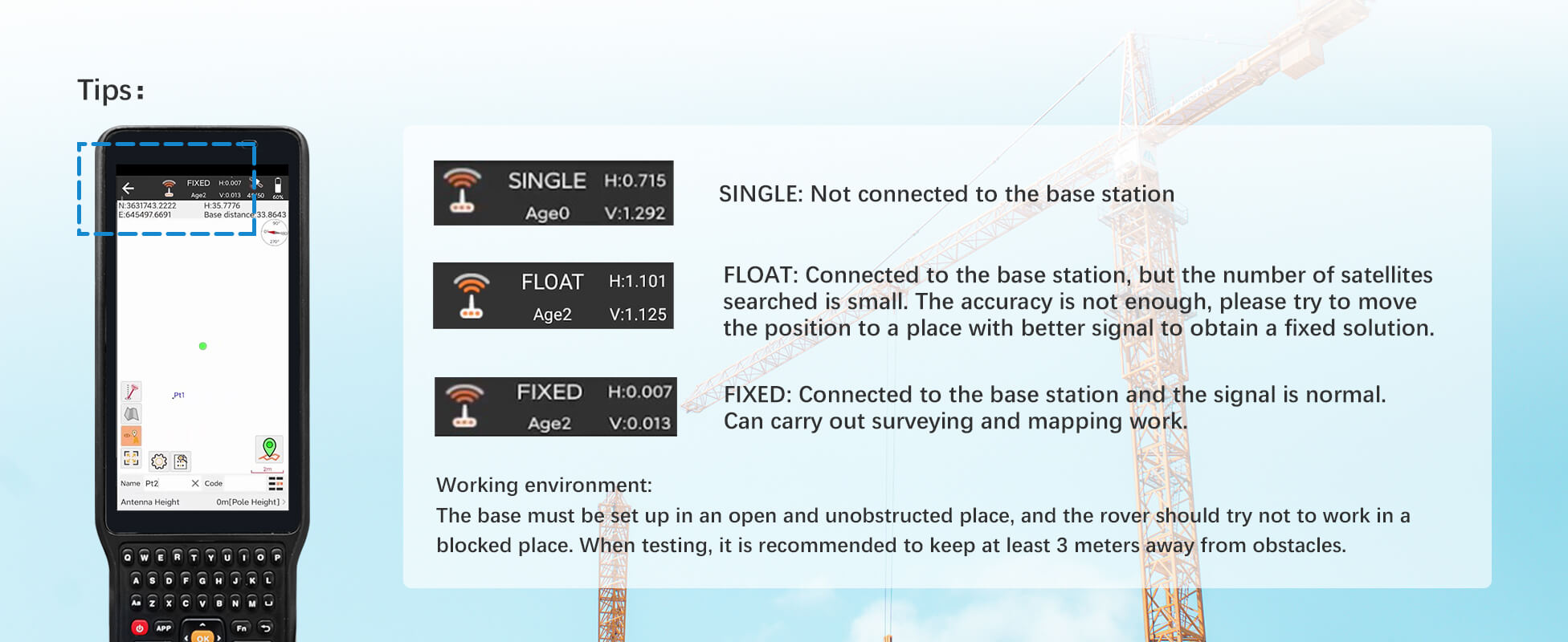
【What is it】R26 v2 RTK GPS Surveying System with IMU, consists of R26 rover and base station and Collector with Surveying software. Double R26 RTK GNSS receiver included, which enables the system to pinpoint measurement and reference locations in a timely and accurate manner. This RTK Survey system is mainly for construction and geodetic surveys or layout planning.
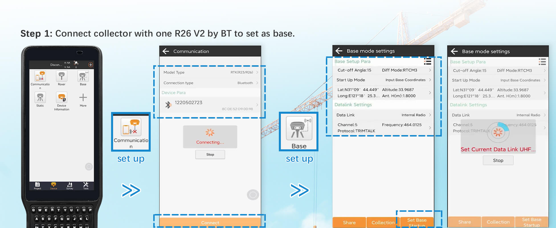
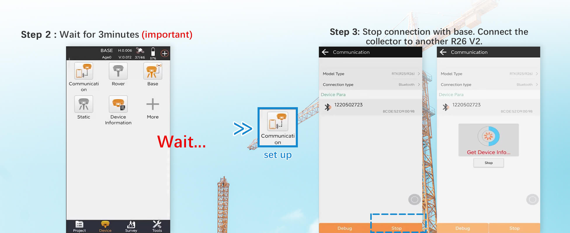
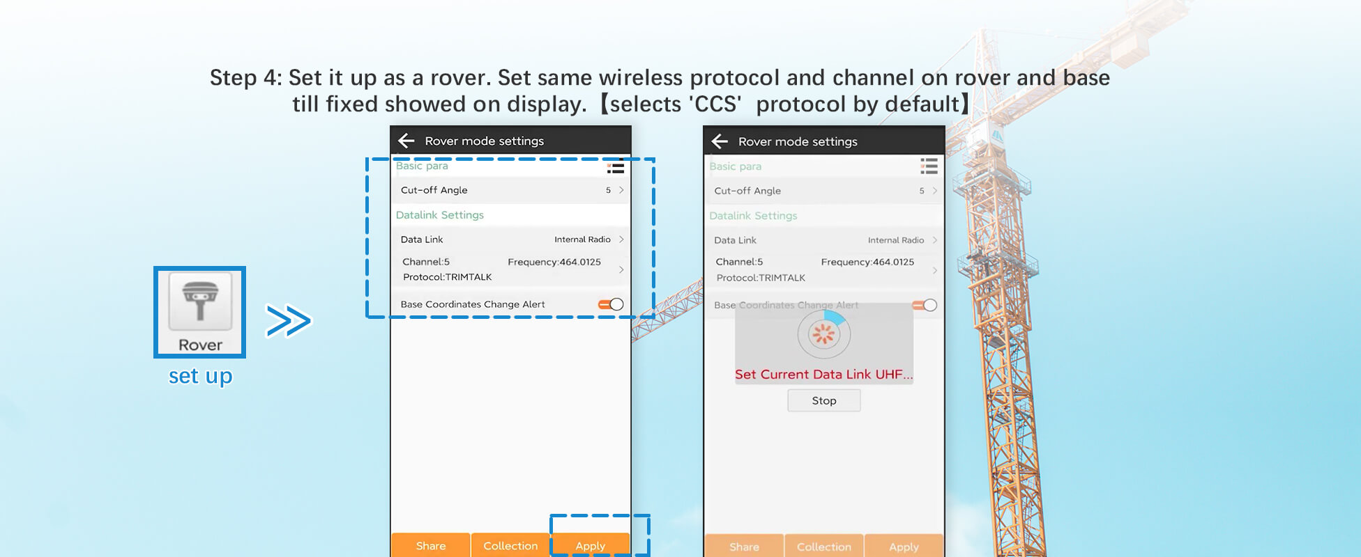
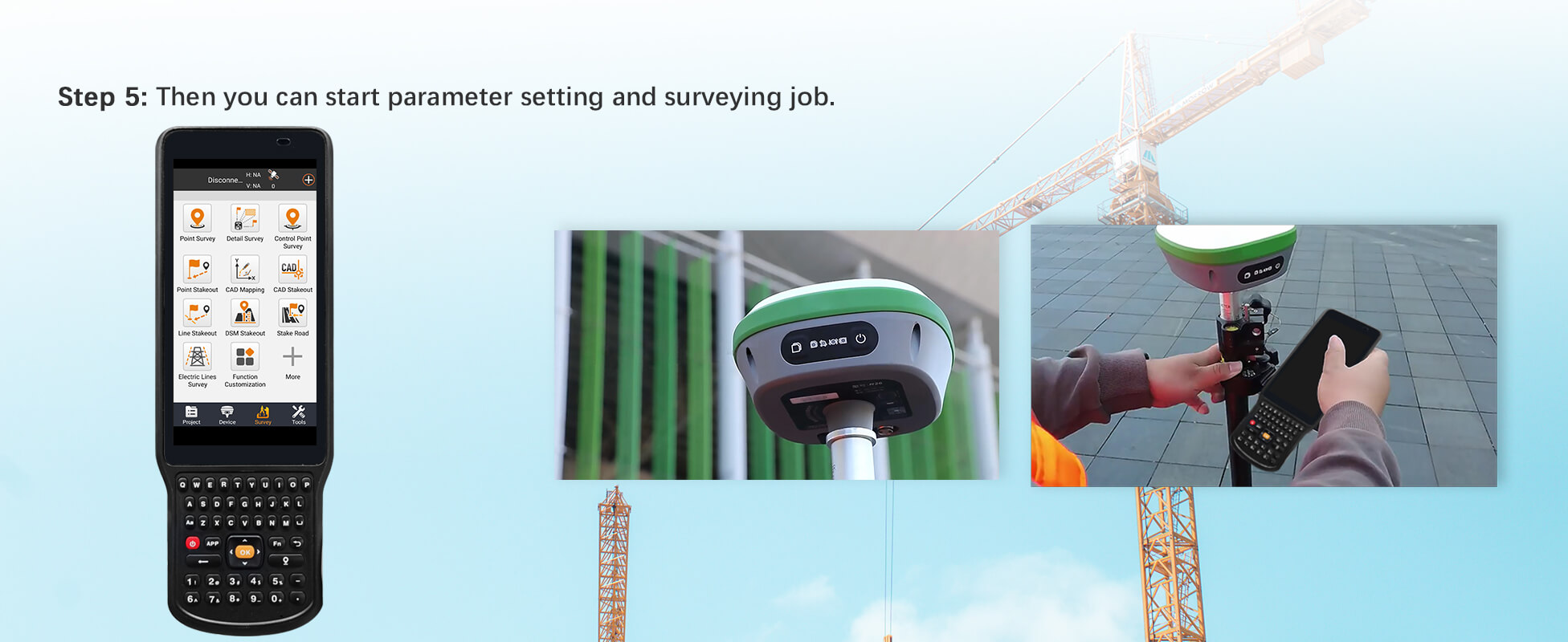
【How to work】step 1:Connect collector with one R26 by BT to set as base, wait for 3minutes(important) , step2:stop connection with base, then connect collector with other R26 to set as rover. Step 3: Set same wireless protocol "CCS" and channel on rover and base till fixed. Then you can start parameter setting and surveying job.
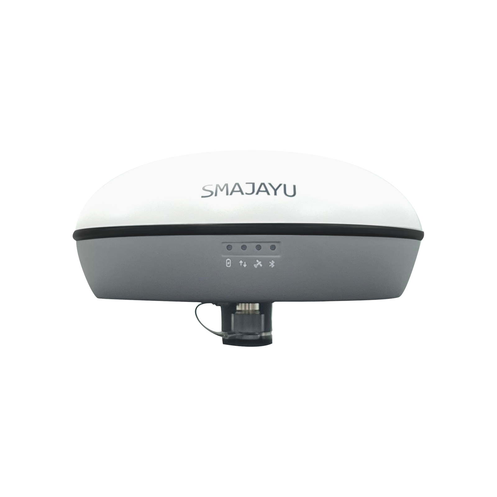
【Where to use】 Accuracy RTK GNSS receiver R26 can meet various surveying & engineering, such as surveying and mapping engineering, geographic information, engineering surveying, mine surveying etc. Fully support GPS, GLONASS, Galileo systems, adapt to a variety of complex and harsh environments
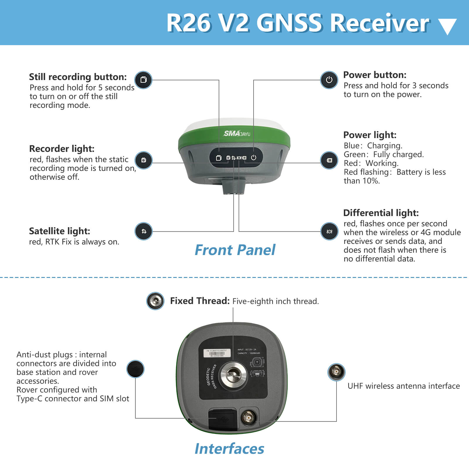
【Why to use】 Built-in BT, wireless , storage, positioning,inertial navigation, antenna and other modules to meet various needs of measurement work. Built-in low-power transceiver integrated wireless module and IMU. It employs a base station and rover with the (GPS) to attain centimeter-level precision measurement. Collector with professional instruction,High precision, low power consumption, small size, easy to carry and operate.
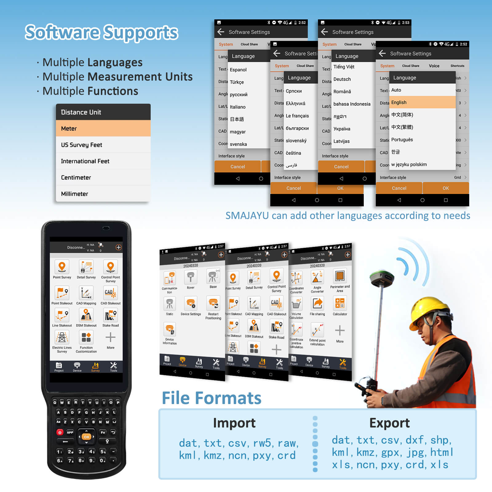
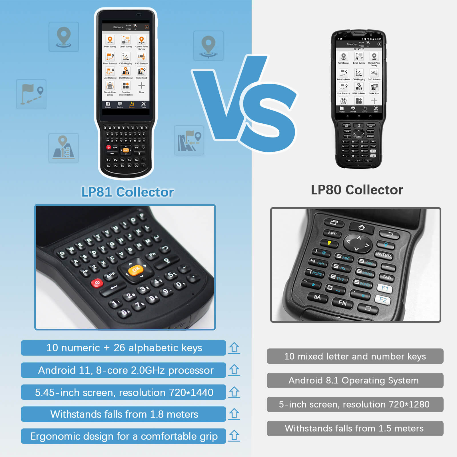
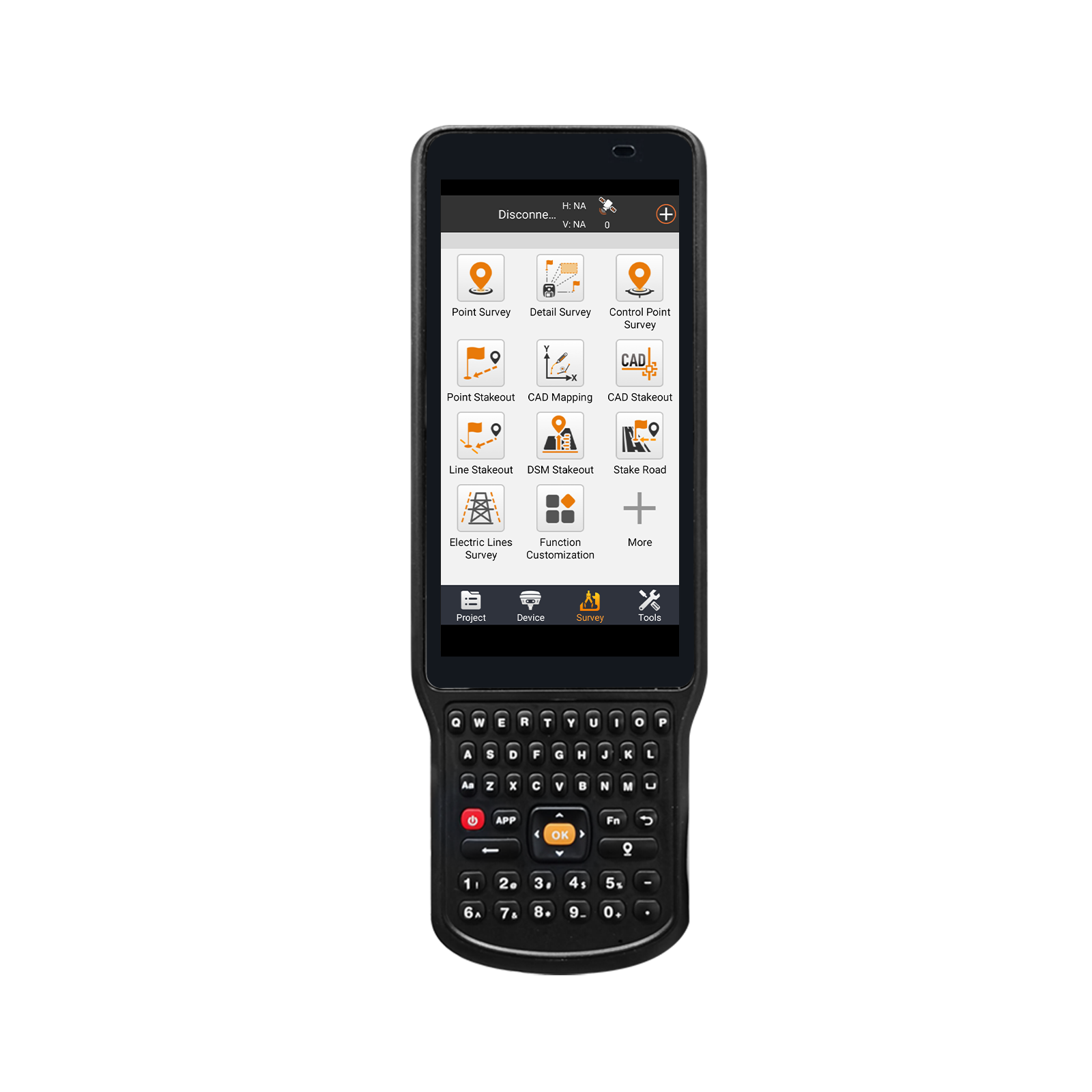
【RTK Software】RTK Surveying software installed in Handheld(Collector) and Permanently Valid. Software download link is always available for user to update the latest software.
【Tech Support】For sure buyer can ontact seller tech team for support to make sure the equipments 100% work well.Please refer to the PDF electronic manual in the webpage.Please email for technical support or Search for SMAJAYU on YouTube.
- Benefit
- Specification
- Download
- Reviews

Related Products
R26 V2 RTK+tripod
$
Reply to you within 24 hours
