In today's fast-paced technological world, precision has become more important than ever. From land surveying to agriculture and construction, businesses and professionals rely heavily on accurate data for decision-making. Have you ever wondered how surveyors, farmers, and engineers achieve such exact measurements? The answer lies in the power of RTK GNSS receivers, which offer centimeter-level accuracy for a variety of applications. But what exactly are RTK GNSS receivers, and how are they changing industries like agriculture, construction, and surveying?

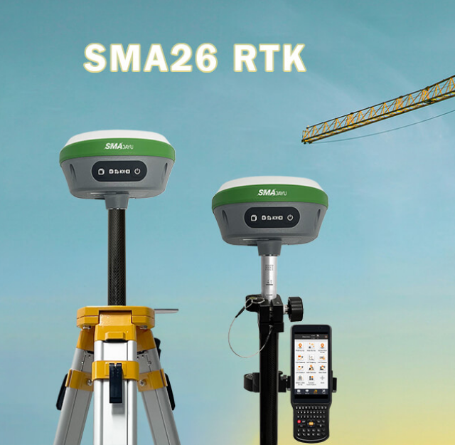
In this blog, we will delve into the setup and calibration of RTK GNSS receivers for optimal performance, explore the latest advancements in the technology, and discuss the key benefits of using these devices for land surveying. We'll also introduce SMAJAYU, a leading RTK GNSS receiver supplier, and examine one of their standout products—the SMA26 RTK+Pole.
How to Set Up and Calibrate Your RTK GNSS Receiver for Optimal Performance
Setting up and calibrating an RTK GNSS receiver correctly is crucial for achieving the highest possible accuracy. Improper setup can lead to errors in measurements, defeating the purpose of using high-precision equipment.
Step 1: Site Selection and Preparation
The first step in setting up an RTK GNSS receiver is selecting an optimal location. It’s essential to choose a site free from obstructions such as tall buildings, trees, or mountains, as these can block satellite signals and reduce the receiver's effectiveness. A clear view of the sky ensures uninterrupted access to GNSS satellite signals, which is critical for the accuracy of the receiver.
Once you have selected the site, it’s important to prepare the area by setting up a stable base. For projects requiring fixed base stations, ensure that the base station remains undisturbed throughout the operation.
Step 2: Setting Up the Base and Rover Stations
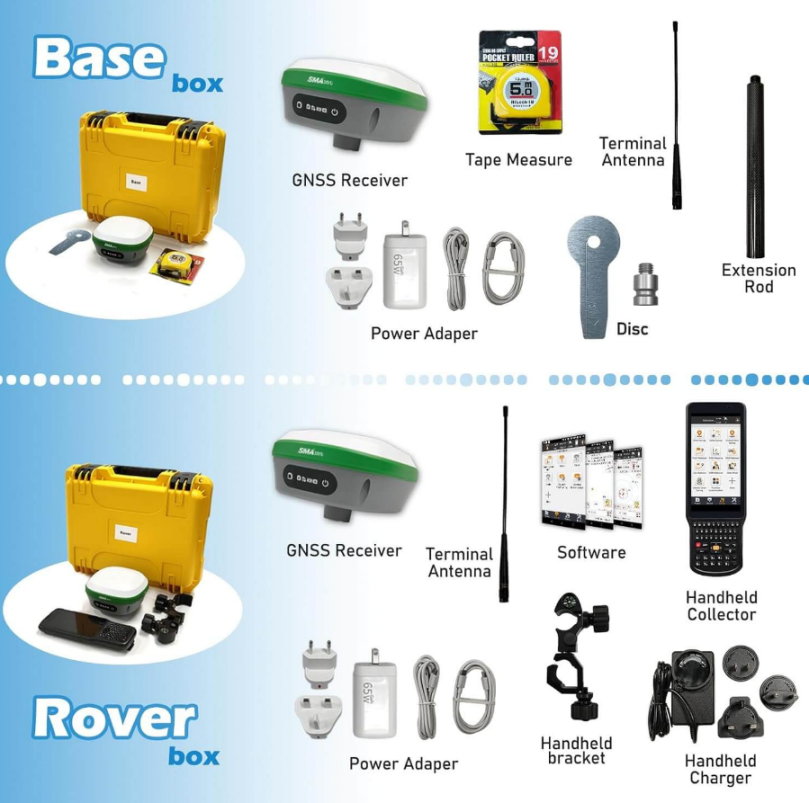
RTK GNSS systems typically consist of two components: the base station and the rover. The base station is a static unit that remains in one location, while the rover moves around to collect data. Proper communication between the base and rover is essential for real-time corrections.
For optimal performance, the base station should be placed in a secure, high-positioned area. Most modern receivers, like the SMA26 from SMAJAYU, come equipped with built-in UHF wireless modules, enabling smooth communication between the base and rover. Once set, you can connect the rover station via the same wireless module and begin calibration.
Step 3: Calibration and Signal Optimization
After setting up the stations, the calibration process begins. This involves aligning the RTK GNSS receiver with the coordinate system of your project, ensuring that the collected data corresponds accurately to real-world coordinates. The receiver will also track satellites to establish its position, a process that can take a few minutes depending on signal strength.
Receivers like the SMA26 feature 1408 signal channels and utilize advanced NebulasIV technology for optimal signal tracking, making calibration faster and more precise. Once the calibration is complete, the system is ready for data collection with the highest level of accuracy possible.
Advancements in RTK GNSS Receiver Technology: What Surveyors Need to Know
RTK GNSS receivers have come a long way in recent years, with significant advancements that are reshaping how professionals approach tasks like land surveying. Whether you’re an experienced surveyor or new to the field, keeping up with the latest innovations is critical for staying competitive.
Enhanced Signal Tracking and Processing
Modern RTK GNSS receivers have improved significantly in terms of signal tracking and processing power. Older models might have struggled with weak signals or interference from the environment, but newer devices like the SMA26 use cutting-edge technology to ensure consistent and reliable performance. The SMA26 boasts 1408 channels for signal tracking, ensuring that it can lock onto even the faintest satellite signals and maintain high accuracy in challenging environments.
Surveyors working in remote or difficult terrain no longer have to worry about losing signal or accuracy, as these advancements in RTK technology allow for seamless data collection in real time.
Multi-Functional Receivers for Versatility
Another advancement in RTK GNSS technology is the integration of multiple functions into a single device. Today’s receivers often include built-in features such as 4G connectivity, Inertial Measurement Unit (IMU) modules, and radio modules, reducing the need for additional equipment on-site.

For example, the SMA26 RTK GNSS receiver by SMAJAYU integrates various technologies that allow it to function as both a mobile and base station. This flexibility can save surveyors both time and money while improving workflow efficiency.
Improved Battery Life for Extended Fieldwork
Battery life is another area where RTK GNSS receivers have seen substantial improvement. Long-lasting battery performance is crucial for surveyors who spend extended hours in the field, often in remote locations. The SMA26 has a built-in 10,200 mAh battery, capable of providing over 14 hours of continuous use. This allows surveyors to work uninterrupted throughout the day without worrying about recharging equipment, even in challenging outdoor conditions.
How RTK GNSS Technology is Transforming Agriculture and Construction
The adoption of RTK GNSS technology is no longer limited to traditional land surveying—it is now driving transformation in agriculture and construction as well.
Precision Agriculture: Maximizing Efficiency and Yield
In agriculture, RTK GNSS technology is enabling farmers to increase efficiency and precision. With centimeter-level accuracy, RTK receivers help farmers optimize their planting, fertilizing, and harvesting processes. This technology allows for the automation of tractors and other machinery, minimizing overlap and reducing waste of resources like seeds and water.
Farmers using RTK GNSS receivers can also engage in soil sampling and land mapping to improve crop yield by identifying areas with poor soil quality or inconsistent irrigation. In short, RTK technology provides the data needed to make more informed decisions, leading to more sustainable and profitable farming.
Construction: Enhancing Accuracy and Reducing Costs
In the construction industry, RTK GNSS receivers have proven invaluable for tasks like grading, excavating, and layout planning. Precision is crucial in these processes, and even the slightest deviation can result in costly errors. By using RTK technology, construction teams can achieve accurate measurements in real time, allowing them to meet design specifications and avoid costly rework.
The technology also streamlines workflows by enabling automation in construction machinery, such as bulldozers and excavators, leading to faster project completion times and reduced labor costs.
Key Benefits of Using RTK GNSS Receivers for Land Surveying
For land surveyors, RTK GNSS receivers offer several key benefits that improve efficiency, accuracy, and overall workflow.
Centimeter-Level Accuracy
The primary advantage of RTK GNSS receivers is their ability to deliver centimeter-level accuracy in real time. This is especially important for land surveying, where precise measurements are essential. Receivers like the SMA26 use advanced algorithms and signal processing techniques to ensure the highest possible accuracy, even in challenging environments.
Real-Time Data Collection
RTK GNSS receivers enable real-time data collection, which speeds up the surveying process significantly. Surveyors no longer have to rely on post-processing to correct data, allowing them to make quicker decisions and deliver results to clients faster.
Versatility and Ease of Use
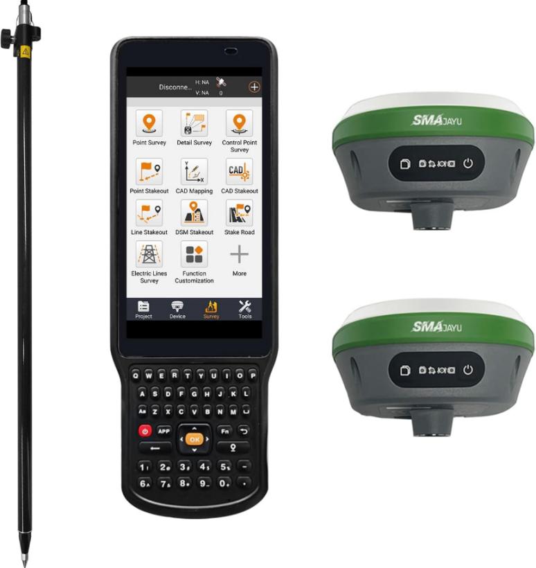
Today’s RTK GNSS receivers are designed for versatility and ease of use. They can be deployed in various environments, from urban construction sites to rural farmlands. Their intuitive interfaces and automatic setup procedures, as seen in the SMA26, make them accessible even for those who are not experts in GNSS technology.
RTK GNSS Receiver Supplier: SMAJAYU
SMAJAYU is a leading supplier of RTK GNSS receivers, offering innovative products designed for precision and reliability in the field. One of their most popular models, the SMA26 RTK+Pole, exemplifies the brand’s commitment to delivering high-performance technology at an affordable price point.

SMA26 RTK+Pole: Built for Performance
Priced at $2,733, the SMA26 RTK+Pole is NOAA-certified and features a built-in GNSS full-frequency antenna, high-precision positioning board, 4G connectivity, IMU, and a radio module. Its large 10,200 mAh battery provides over 14 hours of continuous operation, making it ideal for long days in the field.
Built-in UHF Wireless Module
The SMA26 also includes a built-in UHF wireless module that allows for automatic switching between the mobile and base stations, further simplifying the setup process. Its support for the CSS (LoRa) wireless protocol ensures robust communication in any environment.
Signal Tracking and Accuracy
With 1408 channels and NebulasIV technology, the SMA26 offers industry-leading signal tracking, making it one of the most reliable receivers on the market.
Conclusion
In conclusion, RTK GNSS receivers like the SMA26 from SMAJAYU are revolutionizing industries by providing precision, reliability, and ease of use. Whether you're in agriculture, construction, or land surveying, investing in the right RTK GNSS technology can dramatically improve accuracy and efficiency. As advancements in this field continue to emerge, professionals who embrace these tools will find themselves at the forefront of innovation in their industries.


