In the rapidly evolving world of modern construction, where speed and efficiency are paramount, the importance of precision cannot be overstated. Civil engineering endeavors, characterized by their complexity, demand exacting standards in tasks such as surveying, site layout, and continuous measurement to ensure that projects are not only completed with smooth execution but also remain within set deadlines and financial constraints.

Now, imagine a scenario where you could significantly cut down on rework, markedly boost productivity, and embrace eco-friendly practices—all while keeping expenditures under control. This is where RTK (Real-Time Kinematic) GPS steps in, a revolutionary technology reshaping the landscape of civil engineering. So, how does this technology operate, and what advantages does it bring to the table? By delving into the workings of RTK GPS, particularly the SMA26 RTK+Pole system, we can uncover why this tool is rapidly becoming indispensable for industry professionals.
Cost-Benefit of Using RTK GPS for Civil Engineering Projects
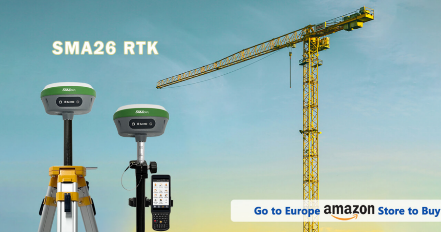
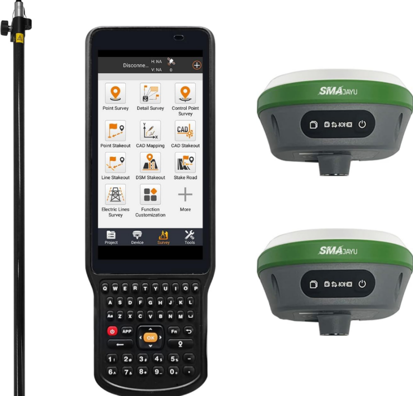
RTK GPS systems are an investment, but the return on that investment can be substantial. Civil engineers who integrate this technology into their workflows quickly see the cost savings and efficiency improvements. The SMA26 RTK+Pole, for example, priced at $2,733, offers more than just high precision; it provides a robust solution for large-scale projects that demand both accuracy and reliability.
Reduced Labor Costs and Faster Project Completion
One of the immediate benefits of using RTK GPS in civil engineering is the reduction in labor costs. Traditional surveying methods are often time-consuming and require multiple workers to set up, measure, and record data. RTK GPS simplifies this process by providing real-time, highly accurate data on-site, cutting the time needed for each task. The SMA26 GNSS receiver, with its built-in GNSS full-frequency antenna and high-precision positioning board, ensures data accuracy while reducing the number of site visits required.
Additionally, the faster data collection means that projects can be completed sooner. This results in fewer labor hours and potentially shorter project timelines, leading to lower overhead costs.
Minimizing Rework and Errors
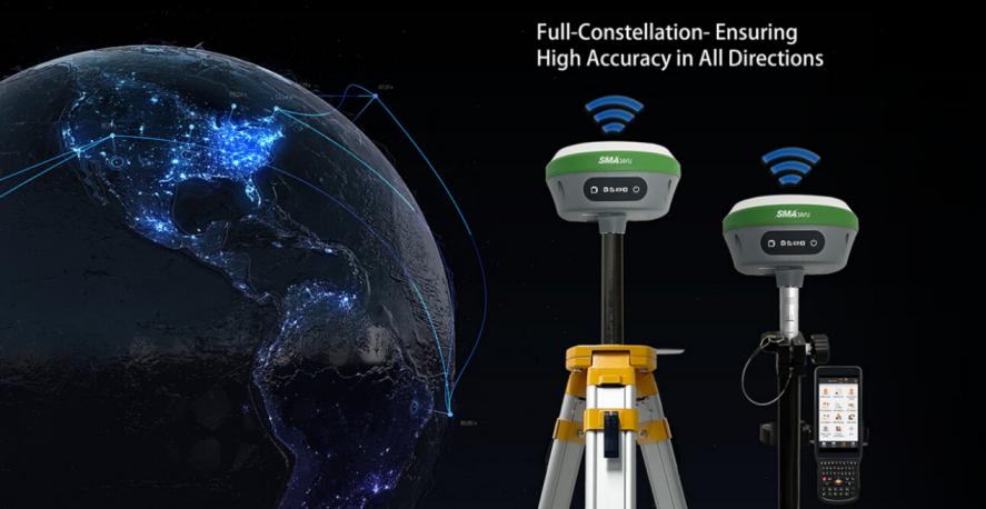
Civil engineering projects are notorious for rework, which can account for up to 30% of total project costs. Mistakes often occur due to inaccuracies in the initial site layout or errors in subsequent measurements. RTK GPS, however, eliminates much of this risk. The SMA26 system receives satellite signals from all constellations and frequency points, ensuring real-time positioning accuracy even in challenging environments. This level of precision means fewer mistakes, less rework, and a significant reduction in overall project costs.
Long-Term Savings with Durable Equipment
The SMA26 RTK system also boasts durability and long battery life, featuring a built-in 10200mAh battery that lasts over 14 hours in harsh outdoor environments. This reduces the need for frequent recharges and equipment replacements, offering long-term savings for civil engineering firms that operate in remote or demanding locations.

How RTK GPS Reduces Rework and Enhances Productivity in Civil Engineering
Rework and project delays are some of the biggest challenges in civil engineering. Fortunately, RTK GPS technology offers a solution by enhancing precision and improving overall productivity.
Real-Time Accuracy for Precise Site Layouts
The core advantage of RTK GPS is its ability to deliver real-time accuracy with centimeter-level precision. In civil engineering, this is critical for site layout and surveying tasks. For example, when using the SMA26 RTK system, engineers can pinpoint exact locations without needing to constantly recalibrate or adjust their equipment. This not only saves time but also ensures that every element of the project is placed precisely where it needs to be, reducing the chances of errors.
Improving Workflow Efficiency
RTK GPS systems like the SMA26 are designed to improve workflow efficiency. The built-in UHF wireless module, which automatically switches between mobile and base stations, means that the system is always connected and ready to transmit data. This seamless integration of components, including the intelligent web page platform (WEBUI), allows engineers to access and share data quickly, making adjustments in real-time without the need for manual intervention.
Versatility Across Various Environments
Civil engineering projects often take place in challenging environments where traditional surveying methods may struggle. The SMA26 RTK GPS system, however, can track signals from more than 40 satellites, ensuring positioning accuracy even in areas with limited satellite visibility. Whether in dense urban environments or remote construction sites, RTK GPS enables civil engineers to maintain productivity and avoid costly delays caused by inaccurate data.
RTK GPS in Site Layout: Improving Accuracy and Reducing Time
Site layout is a crucial stage in any civil engineering project, and RTK GPS technology offers significant improvements in this area. Accurate site layout ensures that all structures, roads, and utilities are placed correctly from the start, minimizing the risk of misalignment or errors that can lead to costly rework.
Simplified Setup and Operation
One of the reasons RTK GPS is gaining popularity in civil engineering is the ease of setup and operation. The SMA26 system is lightweight, portable, and easy to operate, making it ideal for quick deployment on construction sites. With the SMA26 RTK GNSS system, engineers can achieve accurate site layout without the need for extensive manual measurements, reducing the time needed for setup and calibration.
Real-Time Updates for Dynamic Projects
Civil engineering projects are often dynamic, with changing requirements or unexpected challenges. RTK GPS offers real-time updates that allow engineers to adjust site layouts as conditions change. The SMA26 RTK system, with its 1408-channel NebulasIV signal tracking and built-in intelligent system, can adapt to these changes without sacrificing accuracy. This flexibility reduces the likelihood of project delays due to unforeseen issues.
Faster Turnaround for Large-Scale Projects
For large-scale projects, time is money. The ability of RTK GPS to quickly and accurately map out site layouts means that civil engineers can move on to the next phase of the project faster. This is particularly important in projects with tight deadlines or limited resources. The real-time data provided by the SMA26 RTK system allows for faster decision-making, which ultimately reduces the overall project timeline.
How RTK GPS Supports Sustainability in Civil Engineering Projects
Sustainability is becoming an increasingly important factor in civil engineering, and RTK GPS technology can play a crucial role in achieving environmentally-friendly practices.
Reducing Material Waste
One of the ways RTK GPS supports sustainability is by reducing material waste. Precise measurements and real-time data ensure that materials are used efficiently, with minimal overordering or wastage. For example, in road construction or site grading, the accuracy of the SMA26 RTK system can help avoid over-excavation or overfilling, leading to less waste and lower environmental impact.

Minimizing Fuel Consumption
RTK GPS can also help reduce fuel consumption on construction sites. By streamlining workflows and reducing the need for repeated trips to survey the site or correct errors, the use of RTK GPS systems leads to fewer trips by vehicles and machinery. This not only saves fuel but also reduces carbon emissions, contributing to a more sustainable construction process.
Supporting Long-Term Environmental Planning
Civil engineering projects often have long-term impacts on the environment. With the precision offered by RTK GPS, engineers can plan projects in a way that minimizes disruption to natural landscapes and ecosystems. The SMA26 RTK system, for example, can be used to accurately map out sensitive areas, ensuring that construction does not encroach on protected habitats or waterways.
Conclusion: The Future of Civil Engineering with RTK GPS
As civil engineering projects become more complex and environmentally-conscious, technologies like RTK GPS will continue to play a vital role in enhancing accuracy, improving efficiency, and supporting sustainability. The SMA26 RTK+Pole from SMAJAYU, with its high-precision capabilities, long battery life, and ease of use, is a perfect example of how modern GPS systems can revolutionize the industry. Whether you’re looking to reduce costs, minimize rework, or adopt more sustainable practices, RTK GPS offers a comprehensive solution for today’s civil engineering challenges.


