

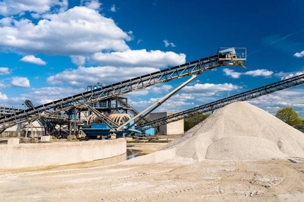
Mining and quarrying need high precision. But why? Operations must be accurate to save time and reduce costs. Errors can lead to wasted materials and safety risks. Traditional surveying methods often cause problems. They take more time and may not give correct results. Workers face challenges when measuring land or tracking equipment. So, how can this problem be solved? Advanced GPS technology is changing the industry. It provides real-time data and better accuracy. With this, mining becomes more efficient. Companies can work faster and reduce mistakes. But how does this technology really help? Let's explore more.
Understanding RTK GPS: A Game-Changer for Accuracy
What is RTK (Real-Time Kinematic) GPS?
RTK GPS is an advanced positioning system. It improves accuracy by using correction data. It works with satellites and a base station. The base station sends real-time corrections to a GPS receiver. This process reduces errors. Standard GPS can have a few meters of error. RTK GPS reduces this error to a few centimeters. This makes it useful for mining and quarrying. Workers need precise location data to work efficiently. Without RTK GPS, errors can lead to material loss and unsafe conditions. So, how does it compare to standard GPS?
How It Improves Accuracy Compared to Standard GPS Systems
Standard GPS provides basic location data. However, it has a high margin of error. This is because satellite signals pass through the atmosphere. Different conditions cause signal delays. RTK GPS solves this problem. It uses a fixed base station and mobile receivers. The base station corrects errors in real time. This allows machines and workers to get precise locations. RTK GPS can achieve centimeter-level accuracy. This is much better than the meter-level accuracy of standard GPS. But how does this help mining operations?
The Role of RTK GPS in Modern Mining Operations
Mining requires careful planning. Mistakes can lead to wasted resources and high costs. RTK GPS helps in surveying and excavation. It provides accurate data for mapping. Workers can track machinery with real-time updates. This improves safety and efficiency. RTK GPS also helps in automation. Self-driving machines rely on accurate positioning. Without RTK GPS, they cannot work properly. Many mining companies now use RTK GPS to improve productivity. So, what makes SMAJAYU a leader in this technology?
SMAJAYU: Delivering Precision GNSS Solutions
SMAJAYU provides advanced GNSS solutions. We focus on precision, orientation, and accuracy. Our technology helps industries like mining and engineering. With over 15 years of experience, we have improved traditional devices. Now, we create smart equipment for better results. Our solutions enhance productivity and efficiency. We lead in precision agriculture, engineering, and surveying. Our mission is to provide reliable tools for modern industries.
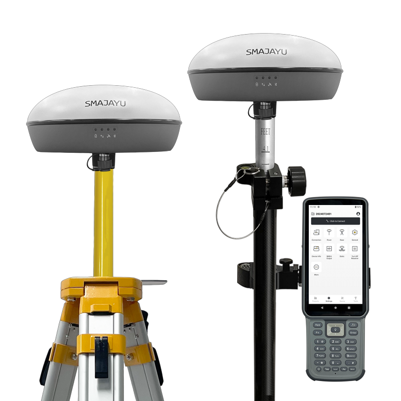
Introducing the SMA20 RTK: Next-Generation Precision
What is the SMA20 RTK, and How Does It Stand Out?
The SMA20 RTK is a lightweight and powerful GNSS receiver. It works well in tough environments. It provides global signal coverage for accurate positioning. The device has an Inertial Measurement Unit (IMU). This allows measurements without leveling the bubble. The tilt survey function makes it easier to measure angles. Workers do not need to worry about holding the device perfectly straight. This makes work faster and more convenient. The SMA20 RTK helps mining teams work with less effort. But what are its key features?
Key Features of the SMA20 RTK
The SMA20 RTK GNSS receiver supports multiple satellite constellations, including GPS, GLONASS, BeiDou, and Galileo, ensuring reliable and precise positioning. It offers RTK, PPK, and PPP correction modes, making it suitable for different applications. The device features static and Rinex logging for accurate data collection. A built-in UHF internal radio (900MHz) enhances connectivity, while Network CORS station connection improves accuracy.
Its RTK accuracy provides ±10mm horizontal and ±18mm vertical precision, with a tilt accuracy of 2.5cm at 30° and a maximum tilt angle of 60°. The static accuracy is ±2.5mm horizontal and ±5mm vertical, while PPK accuracy reaches ±25mm horizontal.
The high-precision IMU includes a gyroscope and accelerometer, improving tilt measurements. With GNSS and IMU integration, surveying at any angle is possible. Even at a 60-degree tilt, accuracy stays within 3 cm, providing greater flexibility in mining and quarrying operations. This makes work more flexible. But how does this help in mining and quarrying?
How the SMA20 RTK Enhances Efficiency and Productivity in Mining and Quarrying
Mining and quarrying need accurate positioning. Errors can lead to wasted materials and delays. The SMA20 RTK helps by providing real-time corrections. Workers get precise measurements quickly. This reduces time spent on manual adjustments. The IMU tilt survey allows measurements in difficult areas. Workers do not need to level the device manually. This makes data collection faster. Machines can also use RTK GPS for automation. With accurate positioning, mining becomes safer and more efficient. The SMA20 RTK is designed for modern operations. It helps companies improve productivity while reducing costs.
Applications of SMA20 RTK in Mining and Quarrying
High-Precision Surveying and Mapping
Mining and quarrying need accurate measurements. Workers must know the exact location of resources. Errors can lead to wasted materials and time. Traditional methods often take longer and are not always correct. The SMA20 RTK helps by providing centimeter-level accuracy. It collects data quickly and improves mapping. Surveyors can get precise land measurements without repeated checks. The IMU tilt technology allows work at different angles. Even on uneven ground, accuracy remains high. This helps in planning excavation and drilling.
Optimizing Excavation and Drilling Operations
Excavation and drilling need exact positions. If locations are wrong, workers may dig in the wrong place. This can waste fuel, time, and resources. The SMA20 RTK gives real-time position data. This helps operators follow plans more accurately. Machines can adjust their positions immediately. The device also works in tough conditions. Bad weather or uneven terrain does not affect its performance. Workers can drill and excavate with fewer errors. This increases efficiency and reduces costs.
Real-Time Fleet Tracking and Automation Integration
Mining sites use many vehicles and machines. It is important to track their locations. Delays can slow down work and increase fuel costs. The SMA20 RTK helps by providing real-time fleet tracking. Operators can see the exact positions of all equipment. This makes it easier to manage operations. The device also supports automation. Self-driving mining trucks need precise location data. With SMA20 RTK, they can move accurately and avoid mistakes. This improves workflow and safety.
Improved Safety and Reduced Operational Risks
Mining and quarrying can be dangerous. Workers must avoid unstable areas. If a machine moves to the wrong location, accidents can happen. The SMA20 RTK helps by giving exact positions. Workers can check safe zones before starting work. Real-time data allows operators to adjust routes quickly. The device also helps in monitoring slopes and land movement. This reduces the risk of landslides or collapses. With better positioning, mining becomes safer for everyone.
Benefits of SMA20 RTK for Mining Operations
Increased Efficiency and Cost Savings
Mining companies want to save time and money. The SMA20 RTK helps by improving accuracy. When positions are correct, work is faster. Less fuel is wasted on wrong digs. Machines do not need to redo tasks. The device has an NOAA-certified GNSS antenna, which ensures strong signal reception. It also has an IP-rated waterproof shell to withstand harsh weather. This means it works in rain, dust, or extreme conditions. Operations stay efficient, and costs go down.
Reduced Material Waste and Improved Resource Management
Mining removes valuable materials from the ground. If mistakes happen, resources get lost. The SMA20 RTK prevents errors in digging and drilling. With better accuracy, workers extract the right materials. Less waste means more profit. Companies can also manage stockpiles better. Knowing exact locations helps in organizing raw materials. This prevents over-extraction and reduces environmental damage.
Seamless Integration with Existing Mining Equipment and Software
New technology should work well with old systems. The SMA20 RTK is designed for easy integration. It connects with existing mining machines and software. Operators do not need to change their entire system. They can use the device with their current tools. This makes it easy to improve operations without big investments. Machines can follow accurate positioning without extra effort.
Enhanced Environmental Compliance Through Precise Planning
Mining must follow environmental rules. Companies need to dig only in approved areas. The SMA20 RTK helps by improving land mapping. It ensures excavation happens in the right spots. This prevents damage to protected zones. Precise digging also reduces land disturbance. With accurate planning, companies can meet regulations. This makes operations more sustainable and responsible.
Get Started with SMA20 RTK for Smarter Mining
Mining needs accuracy. Mistakes waste time and money. The SMA20 RTK gives the right location every time. It helps workers and machines do their jobs better. It makes excavation, mapping, and tracking faster and easier. It reduces errors and keeps workers safe. It works in bad weather and rough terrain. It saves fuel and materials. It fits with your current equipment. It helps meet environmental rules. It is strong, reliable, and easy to use. Upgrade your mining operations now. Get the SMA20 RTK today and start working smarter!
