

The Need for Precision in Utility Mapping
Accurate utility mapping is very important. It helps plan infrastructure and keeps people safe. But why does accuracy matter so much? Utility lines are under the ground and above the surface. If maps are wrong, mistakes can happen. Workers may dig in the wrong place. This can cause damage or even danger.
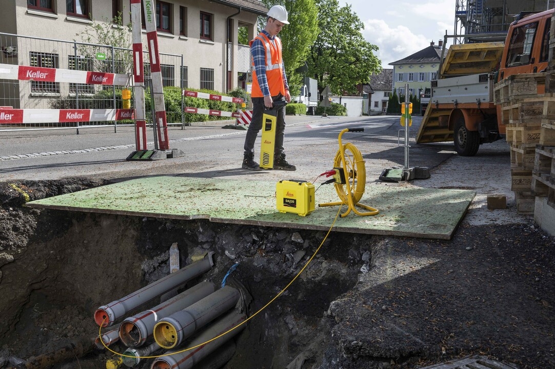
Traditional mapping methods often have problems. They may not show the exact location of utilities. They also take a lot of time. Mistakes are common, and fixing them costs money. So, how can we make utility mapping better? Is there a faster and more accurate way?
What is RTK GPS and How Does It Work?
Overview of Real-Time Kinematic (RTK) GPS Technology
RTK GPS is an advanced technology. It helps measure locations with high accuracy. It is widely used in surveying. This system provides real-time corrections. It makes data collection faster and more precise.
RTK GPS survey equipment, like SMAJAYU, does not need extra processing. It gives instant feedback in the field. Surveyors can check accuracy on the spot. They do not need to re-analyze data or return to the site. This saves time and effort. RTK GPS is useful for many types of surveys. It works well for both level 3 and level 4 surveys.
How It Improves Positioning Accuracy in Mapping
RTK GPS provides real-time positioning. It uses different satellite systems. These include BDS, GPS, GLONASS, Galileo, and QZSS. A dual-frequency system improves accuracy. It ensures that surveys are successful.
RTK GPS works best within 5 kilometers of the base station. For longer distances, accuracy may decrease. To keep precision at 1 centimeter, surveyors use shorter distances. This technology is fast and efficient. But sometimes, results may vary.
Satellite availability affects RTK GPS accuracy. Surveyors need to check the number of satellites before starting a survey. They may have to adjust their schedules. This may seem inconvenient, but it improves efficiency. Proper planning helps get the best results.
Introducing SMA26 RTK: The Game-Changer in Utility Mapping
Expertise Behind SMAJAYU Technology
SMAJAYU has a skilled team. They have over 15 years of experience in GPS technology. Their team is creative and responsible. They focus on high accuracy and reliable performance. SMAJAYU specializes in positioning, orientation, and accuracy calculation. Their goal is to provide the best tools for users. They develop smart and efficient surveying solutions.
Features of the SMA26 RTK System
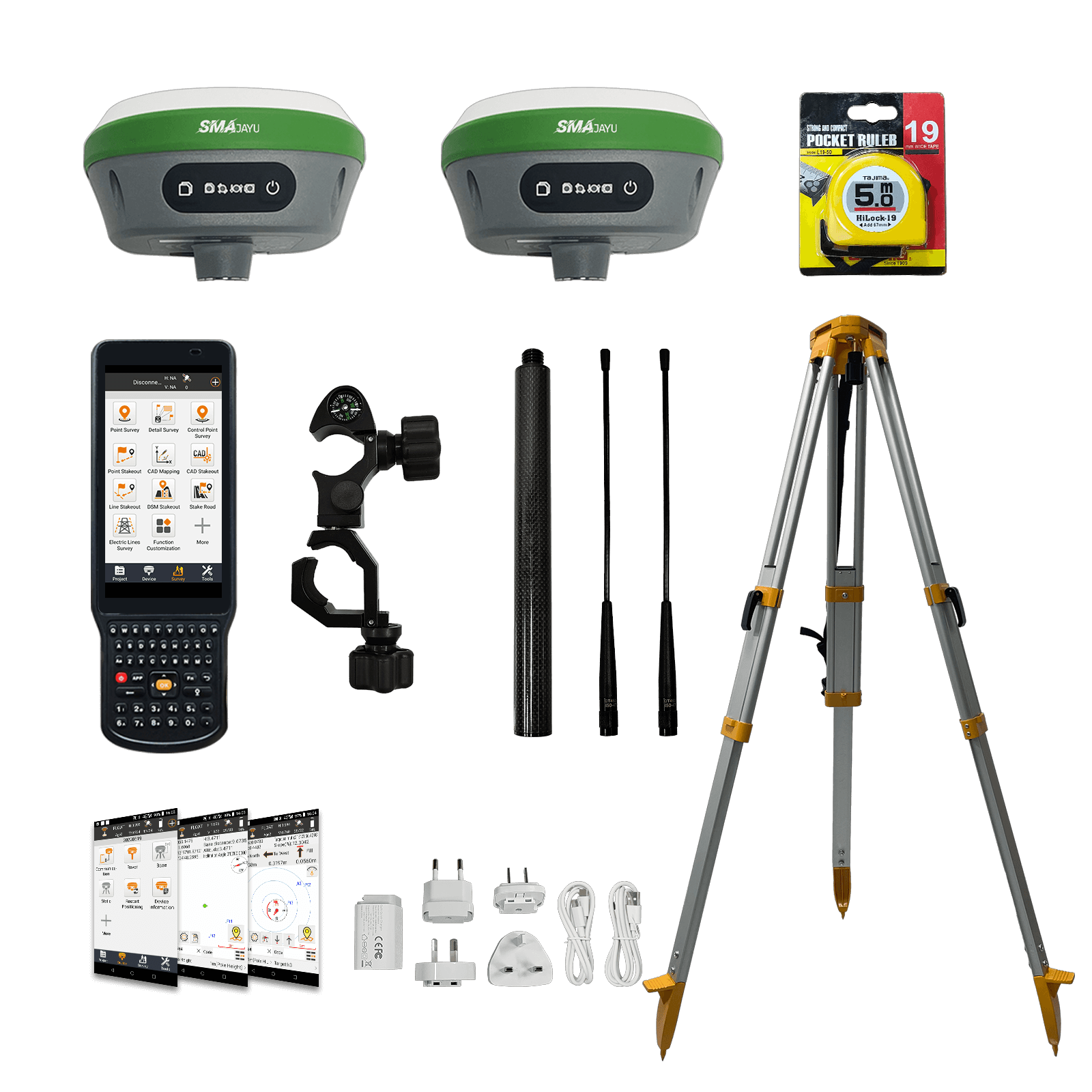
The SMA26 RTK GPS Surveying System is a complete solution. It includes:
- SMA26 rover and base station
- Surveying software and data collector
- Dual GNSS receiver for high accuracy
This system provides real-time corrections. It ensures fast and precise measurements. It is ideal for construction, geodetic surveys, and layout planning.
Accuracy and Performance
The SMA26 RTK GNSS receiver meets many surveying needs. It works for:
- Surveying and mapping engineering
- Geographic information systems (GIS)
- Engineering and mine surveying
It supports GPS, GLONASS, and Galileo systems. It adapts to different environments. Even in tough conditions, it delivers reliable data. The SMA26 RTK system improves accuracy and efficiency in utility mapping.
How SMA26 RTK Enhances Accuracy in Utility Mapping
Reducing Errors in Underground and Above-Ground Utility Detection
Utility mapping needs high accuracy. Mistakes can lead to safety risks and costly repairs. The SMA26 RTK system helps reduce errors. It has built-in Bluetooth, wireless communication, storage, positioning, and an inertial navigation system. These features help collect precise data.
The device has a low-power transceiver, integrated wireless module, and IMU. It works with a base station and a rover. Together, they use GPS signals to achieve centimeter-level accuracy. The system also includes a professional data collector. It is small, lightweight, and easy to carry. It also has low power consumption, so it lasts longer in the field.
Real-Time Data Correction for Pinpoint Accuracy
Surveying errors can happen when signals are weak. The SMA26 RTK system corrects errors in real time. It ensures that data is always accurate. With real-time corrections, surveyors do not need to return to a site to fix mistakes. This saves time and improves efficiency. The high-precision receiver continuously processes signals. It adjusts data as needed. It keeps measurements within centimeter-level accuracy. This makes it reliable for mapping underground and above-ground utilities.
Speed and Efficiency: A New Standard in Utility Surveys
How SMA26 RTK Reduces Survey Time
Surveying takes time. The SMA26 RTK system helps make the process faster. It has a built-in battery with a 10,200mAh capacity. This battery lasts for more than 14 hours. Surveyors can work longer without stopping to recharge.
The system works well in harsh outdoor environments. Its wireless connectivity allows fast data transfer. Surveyors can collect, correct, and store data in real time. This helps complete projects faster.
Minimizing Fieldwork Delays and Improving Workflow
Delays in surveying can slow down construction projects. The SMA26 RTK system helps avoid these delays. It has a wireless protocol (CSS LoRa) and tracks 1,408 channels. It uses NebulasIV technology to ensure smooth operation. The device quickly processes data. It reduces the need for repeated measurements. Surveyors can move to the next task faster. The system improves overall workflow and efficiency.
Applications of SMA26 RTK in Utility Mapping
Success Stories
Many professionals use SMA26 RTK for utility mapping. It helps detect underground pipelines, power lines, and other utilities. It prevents mistakes in excavation and construction. Surveying companies have reported faster project completion and fewer mapping errors. Construction firms use it to map utility lines before digging. This reduces accidents and damage.
Benefits for Utility Companies, Construction Firms, and Municipalities
Utility companies need accurate maps to manage underground assets. The SMA26 RTK system helps them update records and prevent service disruptions. Construction firms benefit from faster and more reliable mapping. They avoid costly mistakes caused by inaccurate utility locations. Municipalities use this system for city planning and maintenance. They rely on precise data to manage roads, utilities, and public infrastructure.
Cost Savings and Long-Term Benefits of RTK GPS
Reducing Rework and Costly Errors
Errors in utility mapping can be expensive. Digging in the wrong place can damage pipelines and cables. The SMA26 RTK system helps prevent these mistakes. It ensures precise mapping and reduces the need for rework. Surveyors can verify data on-site. They do not need to return later to fix errors. This saves both time and money.
Improving Asset Management and Maintenance Planning
Utility companies need accurate location data to manage their assets. The SMA26 RTK system provides precise and up-to-date records. This helps with maintenance planning and reduces unexpected failures. City planners and engineers use this system for long-term infrastructure projects. It improves decision-making and reduces project delays. Over time, the accuracy of RTK GPS leads to better asset management and lower costs.
Upgrade Your Utility Mapping with SMA26 RTK - Get Precision Now!
Accurate utility mapping is important. Mistakes cause delays and extra costs. The SMA26 RTK system gives precise data. It reduces errors in underground and above-ground detection. It works in real time. It improves accuracy with fast corrections.
Surveyors save time. The system has a long battery life. It works in tough conditions. It makes work faster and easier. Many companies trust it for better results.
Avoid costly mistakes. Improve efficiency. Get better data. Upgrade to SMA26 RTK today. Start mapping with confidence. Contact us now to learn more!
