Have you ever wondered how surveyors achieve pinpoint accuracy in the most challenging environments? Imagine surveying a rugged terrain without the need for real-time data transmission, yet still achieving centimeter-level precision. This is the promise of SMA20 PPK (post processed kinemic )Survey technology. Let’s dive deeper into what PPK surveys are and explore how SMAJAYU’s SMA20 system is setting new standards in precision surveying.

What is PPK (Post-Processed Kinematic) Survey?
Understanding the Basics of PPK
PPK, or Post-Processed Kinematic, is a method of precise positioning used in surveying that involves collecting data in the field and then processing it later to determine accurate positions. Unlike RTK (Real-Time Kinematic), which requires a constant data link between a base and rover to get instant position results, PPK offers the flexibility to record data and process it afterwards for highly precise outcomes. This makes it ideal for challenging environments where real-time data transmission may not be feasible or reliable.
PPK surveys are often used in industries that demand high accuracy, such as construction, mining, agriculture, and geospatial mapping. The significant advantage of PPK is its ability to work effectively without a live correction link, meaning it can achieve precise positioning even in areas with no cellular coverage.
PPK vs RTK: When Precision Meets Flexibility
In simple terms, Educorpus PPK is about processing your positioning data after you return from the field, while RTK provides instant, real-time positioning. Each method has its own benefits, with RTK excelling in situations requiring immediate feedback, and PPK shining when reliability and flexibility are key. PPK surveys ensure that even if there are disruptions in communication between devices, accurate positioning data can still be extracted. This reliability is what makes PPK surveys a trusted choice for many applications.
Introducing the SMA20 PPK Survey System
What is the SMA20 PPK Survey?
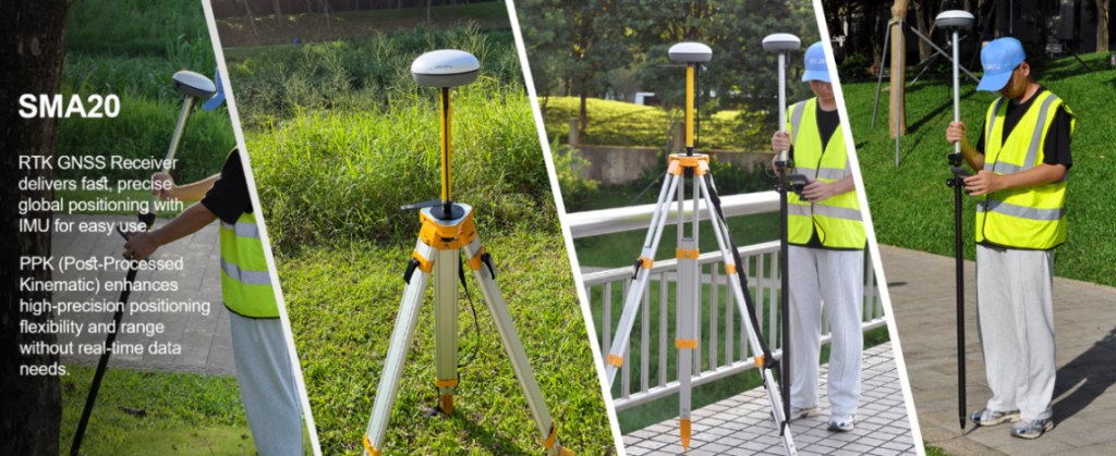
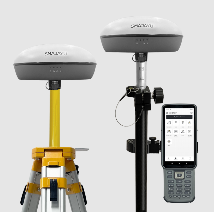
The SMA20 PPK (post processed kinemic )Survey refers to using the SMA20 RTK GNSS Receiver in PPK mode to achieve extremely high accuracy in positioning tasks. Developed by SMAJAYU, the SMA20 system is built to deliver robust positioning results through its advanced GNSS technology and the power of an onboard Inertial Measurement Unit (IMU).
The SMA20 is a versatile and lightweight GNSS receiver that can handle both RTK and PPK modes, making it suitable for all kinds of surveying environments—whether you need real-time positioning or prefer post-processing data to get the highest precision. With PPK capabilities, the SMA20 allows users to take measurements without relying on real-time data links, and instead processes that data afterwards, giving surveyors the flexibility they need.
SMA20 RTK Rover + Base: PPK Capabilities
SMA20 RTK GNSS Receiver: Built for Precision
The SMA20 RTK GNSS Receiver developed by SMAJAYU is designed for modern surveying tasks where accuracy and flexibility are essential. It features a built-in high-precision IMU module that enhances its capabilities significantly. The IMU system includes a gyroscope and an accelerometer, which are primarily used for tilt measurements—meaning you can conduct accurate surveys without the need to perfectly level the receiver. This feature alone provides a major boost to efficiency and convenience.
With the integration of GNSS and IMU, the SMA20 RTK GNSS Receiver supports surveying at any angle and maintains a positioning accuracy of 3 cm even within a tilt angle of up to 60°. This makes the SMA20 particularly useful in environments where maintaining a perfectly vertical position is impractical—think rocky terrains, densely vegetated areas, or urban landscapes.
The Power of PPK for Versatile Applications
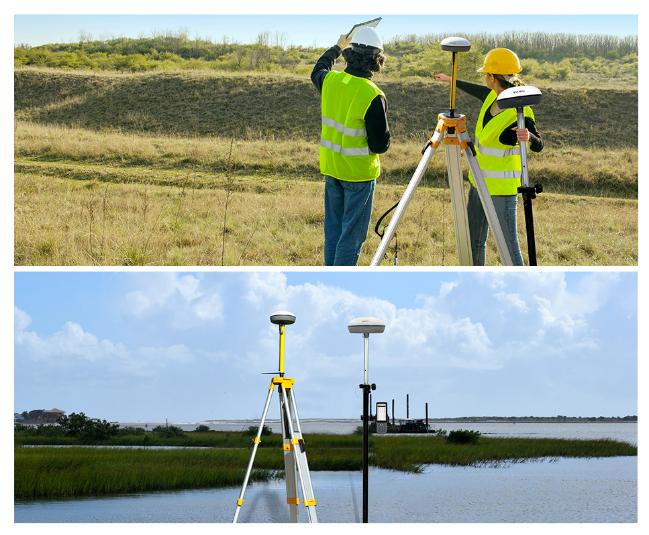
The SMA20 can operate in both RTK and PPK modes, giving it the adaptability needed for diverse fieldwork. With PPK, users do not need to rely on real-time connectivity between the base and rover units, which means that the SMA20 can work just as effectively in remote areas with no cellular coverage. Once the data is collected, it can be processed using specialized software to determine precise position information. This flexibility in data collection and processing is one of the greatest strengths of PPK, making it particularly attractive for use in complex or difficult environments.

Why Choose the SMA20 for PPK Surveys?
Enhanced Accuracy with the IMU Module
One of the standout features of the SMA20 PPK (post processed kinemic )Survey is its integrated IMU module, which brings tilt compensation to the surveying process. Traditionally, surveyors have to ensure that the survey rod is held perfectly vertical to avoid measurement errors. However, the SMA20’s IMU makes this unnecessary by allowing for tilt measurements up to 60° while still ensuring a positioning accuracy of up to 3 cm. This feature not only saves time in the field but also makes surveying significantly more efficient, allowing for faster data collection in environments that would otherwise be challenging.
Seamless Data Collection and Processing
The SMA20’s ability to function as both a real-time RTK and a post-processed PPK system means users can choose the best approach for their specific needs. In areas with solid network coverage, the RTK mode offers immediate positioning information, allowing surveyors to verify data accuracy in real time. Meanwhile, in areas where a continuous signal cannot be guaranteed, the PPK mode ensures that the collected data can still be processed to achieve the same level of accuracy, without being affected by interruptions in real-time communication.
This flexibility makes the SMA20 PPK (post processed kinemic )Survey an excellent choice for a wide range of surveying applications, from urban construction sites to remote agricultural fields. Surveyors can confidently undertake their projects knowing that, regardless of the environment, the SMA20 has them covered with precise and reliable results.
SMA20 RTK: Surveying Made Simple and Efficient
Lightweight Design for Tough Environments
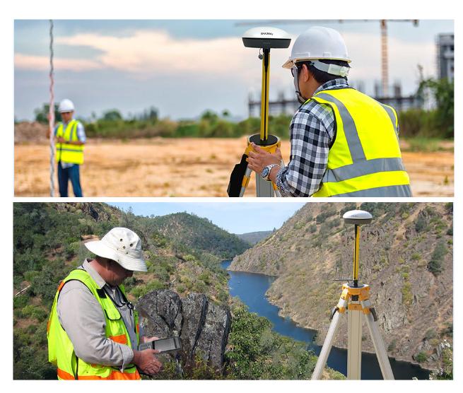
Surveying can be physically demanding, especially in difficult environments such as dense forests, rocky hillsides, or large construction sites. The SMA20 RTK GNSS receiver is designed with this in mind. It is both versatile and lightweight, which means surveyors can carry it with ease throughout long days of data collection. Despite its compact form, it does not compromise on performance and consistently delivers high accuracy regardless of the environment.

The SMA20 PPK (post processed kinemic )Survey is designed for use in diverse conditions and can handle everything from harsh weather to tricky surveying angles. By providing global signal coverage, it enables surveyors to work efficiently, regardless of their location.
IMU for Tilt Survey: Leave the Level Bubble Behind
The SMA20 PPK (post processed kinemic )Survey is engineered with an Inertial Measurement Unit (IMU) that simplifies the surveying process considerably. The IMU integration allows for tilt-compensated measurements, which eliminates the need for surveyors to monitor and level the bubble continuously. This translates to a significant reduction in the amount of time needed for each measurement, ultimately improving productivity. Surveyors no longer have to waste time trying to ensure the rod is perfectly level—instead, they can focus on covering more ground and gathering more data.

The IMU-supported tilt survey offers a more convenient way of working, reducing the need for repetitive adjustments and allowing surveyors to easily adapt to the physical conditions of the survey site. For complex terrain where traditional leveling would be difficult or impossible, the SMA20 proves to be an indispensable tool.
The Benefits of SMA20 PPK Survey Technology
Flexibility for Various Applications
The combination of RTK and PPK capabilities in the SMA20 provides surveyors with the ultimate flexibility. Whether it is being used for land surveying, construction projects, or topographic mapping, the SMA20 delivers the accuracy needed for precise results. When network coverage is available, the real-time RTK mode provides instant feedback and allows surveyors to verify their results on the spot. When network coverage is not available, PPK ensures that the same level of accuracy can still be achieved through post-processing.
Dependable Performance from SMAJAYU
SMAJAYU, the supplier of the SMA20 PPK Survey system, has built a reputation for delivering dependable, high-precision GNSS technology. The SMA20 is no exception, offering users the precision, convenience, and flexibility needed for a wide range of surveying tasks. With global positioning capabilities and IMU technology for enhanced ease of use, the SMA20 is well-equipped to meet the demands of modern surveyors.
Conclusion: SMA20 PPK Surveys for High-Precision Needs
The SMA20 PPK survey system is changing the landscape of precision surveying, offering surveyors an efficient, accurate, and flexible way to gather data. By combining RTK and PPK capabilities with an advanced IMU module, the SMA20 provides high-precision positioning without the constraints of real-time data needs. This makes it suitable for everything from complex construction sites to remote wilderness areas.
Surveying professionals seeking a reliable, adaptable, and high-accuracy solution should look no further than SMAJAYU’s SMA20. Whether you’re dealing with challenging environments, variable network conditions, or simply need a powerful, lightweight GNSS solution, the SMA20 has the capabilities needed to deliver.
Ready to explore the future of high-precision surveying? Learn more about SMAJAYU and their SMA20 system to see how PPK technology can transform your next project.


