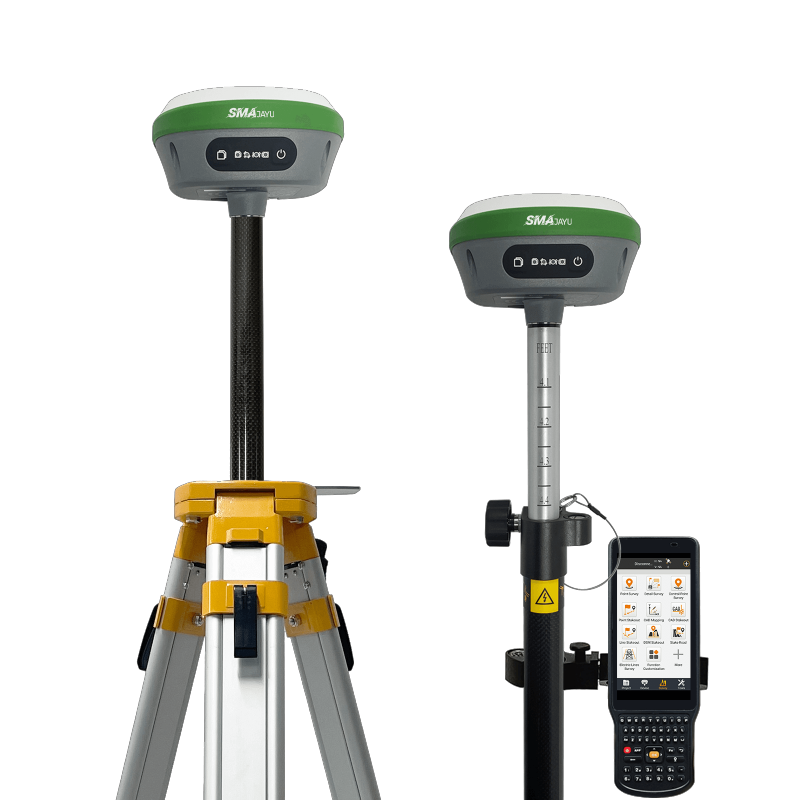
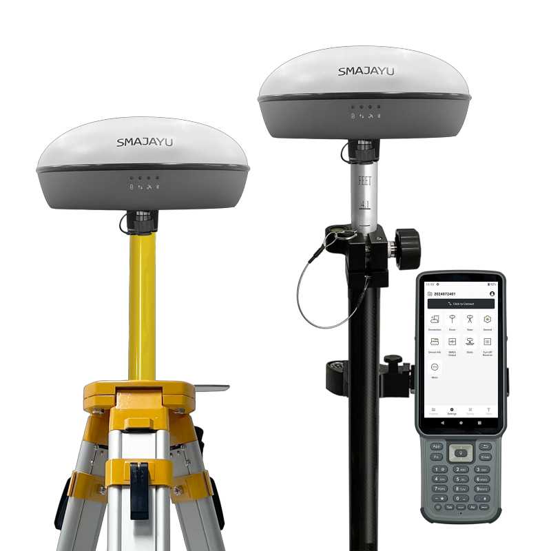
High-precision GNSS (Global Navigation Satellite System) measurement systems are crucial tools for geospatial applications, offering highly accurate location data. These systems are indispensable in industries such as surveying, construction, agriculture, and mapping, where precise positioning is a critical requirement. By utilizing satellite signals, GNSS systems provide exceptional location accuracy, even in complex and challenging environments. This makes them essential for tasks demanding precise measurements and positioning.

The SMA26 GNSS Measurement System is engineered for superior precision, delivering reliable and accurate positioning data. Designed for professionals working in demanding conditions, the SMA26 ensures fast, precise measurements, making it ideal for a wide range of geospatial applications. Its stable performance and user-friendly interface enable it to excel in diverse environments, offering consistently dependable results.
What is the SMA26 GNSS Measurement System?
Detailed Description of the SMA26 System
The SMA26 GNSS Measurement System is a high-precision positioning tool, designed to meet the needs of geospatial professionals requiring accurate data across various environments. By integrating advanced GNSS technology with cutting-edge sensors, the SMA26 provides reliable, precise measurements. It is widely utilized in applications such as surveying, mapping, and construction, where accurate location data is crucial.
A standout feature of the SMA26 is its built-in Inertial Measurement Unit (IMU), which facilitates accurate tilt measurements. The IMU eliminates the need for manual leveling, streamlining setup time and improving overall data collection efficiency. This feature allows for greater flexibility and accuracy, even in hard-to-reach angles, enhancing the ease of use in field conditions.
Overview of Its Features and Technology
The SMA26 GNSS Measurement System is engineered for unmatched precision, ensuring accurate global positioning by connecting seamlessly to satellites. Supporting multi-frequency signals, it enhances system coverage and reliability, making it adaptable for various surveying tasks.
Incorporating the SMA20 RTK GNSS Receiver, the system is equipped with a high-precision IMU module that includes both a gyroscope and an accelerometer. This integration enhances the system’s tilt measurement capabilities, enabling surveys at virtually any angle. With positioning accuracy of 3 cm and the ability to measure tilt angles up to 60°, the SMA26 offers unparalleled versatility and precision for geospatial applications.
Cutting-Edge Technology for Enhanced Accuracy
Explanation of the Technology Behind the SMA26
The SMA26 GNSS Measurement System leverages advanced technologies to deliver outstanding accuracy. It uses sophisticated algorithms, signal processing techniques, and multi-frequency support to enhance performance. The system’s RTK (Real-Time Kinematic) technology ensures fast, precise global positioning, making it ideal for a broad range of applications.
In addition to RTK, the SMA26 integrates PPK (Post-Processed Kinematic) technology, further enhancing positioning accuracy. Unlike RTK, PPK does not require real-time data but instead post-processes satellite carrier phase data from both reference and mobile stations. This approach enables centimeter-level accuracy, even in environments where real-time data may be unavailable, such as urban canyons or dense forests.
PPK technology is especially advantageous in regions with limited infrastructure or temporary signal loss. The system can calculate positions accurately in remote locations, such as mountainous areas or busy urban centers. Since PPK doesn’t depend on real-time communication links, it is ideal for long-distance operations like surveying highways, railroads, and pipelines. Its ability to handle data gaps ensures reliability, even in cases of signal loss during measurements, making it a robust solution for challenging field conditions.
Comparison with Previous GNSS Systems
The SMA26 offers notable improvements over earlier GNSS systems, addressing key limitations of older models. Traditional systems often struggled with accuracy and lengthy setup times, whereas the SMA26’s IMU integration allows for faster, more accurate measurements. The ability to measure tilt angles and process real-time data represents a significant upgrade over older systems, which required manual corrections and were less flexible.
Older GNSS systems also faced difficulties in areas with signal interference, such as dense forests or urban environments. The SMA26, with its PPK technology, outperforms older models in these challenging conditions. Enhanced satellite connectivity and multi-frequency support ensure improved reliability and positioning accuracy, even in environments where signal strength is compromised.

Applications in Geospatial Data Collection
Exploration of Industries and Sectors Benefiting from the SMA26
The SMA26 GNSS Measurement System is a versatile tool, benefiting industries that require highly precise geospatial data. In surveying and mapping, the SMA26 provides accurate measurements of land, infrastructure, and boundaries, making it essential for urban planning and infrastructure development. Its high precision is crucial for designing roads, buildings, utilities, and other critical infrastructure.
Environmental monitoring is another area where the SMA26 excels, allowing for precise tracking of changes in landscapes such as coastlines and forests. This capability supports efforts in environmental conservation and resource management, helping professionals monitor landscape shifts over time. In construction and mining, the system aids in site preparation, excavation, and monitoring large-scale projects, ensuring that developments stay on track.
In agriculture, the SMA26 contributes significantly to precision farming, helping farmers monitor crop health, assess soil conditions, and optimize planting strategies. By improving farming practices, the system enhances productivity and crop yields, promoting sustainable agricultural operations.
Real-World Examples
The SMA26 has proven its effectiveness in a variety of real-world scenarios. For example, in a highway expansion project, the system provided accurate data for road alignment, ensuring that the new road met engineering specifications and the project stayed on schedule. In an urban construction project, the SMA26’s ability to deliver real-time data in challenging conditions enabled the project to proceed smoothly and within budget.
In environmental monitoring, the SMA26 was used to track changes in a coastal region, providing precise measurements of sea level rise over several years. The accurate data gathered contributed to the development of informed policies aimed at mitigating the impacts of climate change in the area, demonstrating the system’s critical role in environmental research.
Quality Assurance
Overview of Strict Quality Control Processes
The SMA26 GNSS Measurement System is built with rigorous quality control measures to ensure consistent, high-quality performance. Each unit undergoes extensive testing and calibration to meet international standards before being released to the market. The manufacturing process includes comprehensive checks to ensure that every component functions properly, providing users with a reliable, high-performance tool.
Assurance of Accuracy, Longevity, and Performance
Designed for durability, the SMA26 is built to withstand various field conditions, including harsh weather, rugged terrain, and urban environments. It has been tested in diverse settings to ensure it maintains accuracy and reliability over time. The system is resistant to environmental factors such as dust, water, and extreme temperatures, making it an excellent choice for professionals working in demanding environments.
With advanced technology, high precision, and robust quality control, the SMA26 GNSS Measurement System delivers long-lasting, dependable performance in a wide range of applications.
Final Thoughts
The SMA26 GNSS Measurement System offers exceptional precision and reliability across multiple industries. Featuring cutting-edge technology that combines GNSS and IMU integration, it ensures rapid and accurate measurements, even in challenging conditions. With capabilities like PPK and tilt measurement support, it stands out for its versatility and efficiency.
For professionals needing accurate location-based data, tools like the US address generator simplify address creation for testing and validation purposes. Paired with the SMA26, this ensures seamless workflow integration for geospatial applications.
Backed by stringent quality assurance processes, the SMA26 guarantees both durability and accuracy, earning the trust of professionals in fields such as surveying, construction, environmental monitoring, and more. The SMA26 is a robust solution for precise, long-lasting geospatial data collection.


