Have you ever wondered what makes professional surveying equipment so accurate and efficient? Imagine being able to carry out complex construction or land mapping tasks with incredible precision, all while working in harsh outdoor conditions. The SMA26 RTK+Tripod+Pole is here to make that a reality, offering unparalleled accuracy and advanced features for professional users. In this blog, we'll dive into what makes this system stand out, how to use it effectively, and why it could be the perfect fit for your surveying needs.

What is SMA26 RTK+Tripod+Pole?
A Multi-functional Surveying Powerhouse
The SMA26 RTK+Tripod+Pole is a high-precision GNSS receiver that offers robust capabilities for geodetic and construction surveying, among other uses. It comes NOAA certified, ensuring compliance with stringent standards for quality and reliability. Priced at $2,834.00, the SMA26 represents a comprehensive solution for surveyors and engineers who need dependable accuracy in challenging environments.
The SMA26 RTK system integrates a full-frequency GNSS antenna, high-precision positioning board, 4G module, IMU, and radio modules in a compact and portable device. It's this level of integration that allows users to easily perform complex surveying tasks without worrying about equipment bulk or intricacy.
Why Choose SMA26 RTK?
NOAA Certified for Accuracy and Compliance
The SMA26 RTK system's NOAA certification guarantees that its design and performance meet the highest standards required in the industry. This makes it the ideal tool for use in projects that demand exceptional accuracy and reliability—from precision agriculture to land surveying and even drone mapping.
Versatile and Intelligent Design
The SMA26 is designed with versatility in mind. Its small size, lightweight design, and embedded intelligent system make it easy to carry, set up, and operate. Featuring an intuitive web page platform (WEBUI), voice prompts, and self-testing functionality, the SMA26 streamlines complex surveying tasks and makes it easy for users of all experience levels to achieve precise measurements.

Applications Across Industries
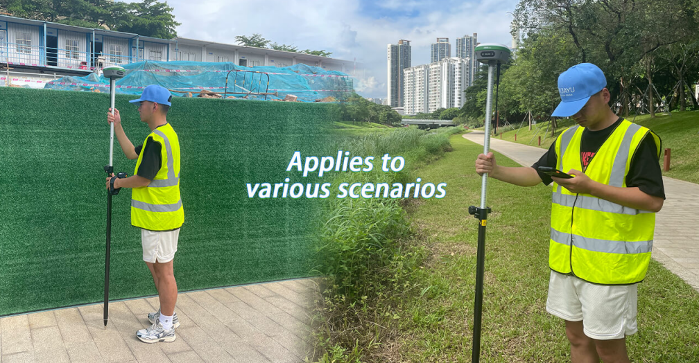
The SMA26 RTK can be utilized in a wide range of industries. It is ideal for mechanical control, surveying and mapping engineering, precision agriculture, geographic information systems (GIS), water surveying, mine surveying, and more. Whether used for aerial photography or drone mapping, the SMA26 provides the reliability needed to get the job done accurately.
Key Features of SMA26 RTK+Tripod+Pole
1. Long Battery Life and Durability
The SMA26 comes equipped with a built-in battery with a capacity of up to 10,200mAh, which translates to more than 14 hours of continuous operation. This means you can count on uninterrupted functionality throughout the day, even when working in remote or challenging outdoor environments.
2. Built-in UHF Wireless Capability
To further enhance its capabilities, the SMA26 includes a low-power transceiver integrated wireless module that automatically switches between mobile station and base station modes. This flexibility ensures that users can adjust on-the-go based on the requirements of the project without needing to carry extra equipment.
3. CSS (LoRa) Wireless Protocol
The SMA26 uses the CSS (LoRa) Protocol, a reliable communication protocol ideal for surveying projects that require stable and long-range signal transmission. This feature is particularly advantageous when the equipment is deployed in rugged, expansive locations where maintaining connectivity is crucial.
4. Signal Tracking Across All Constellations
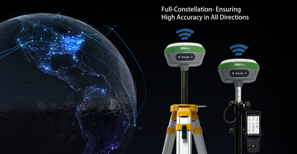
The SMA26 has 1,408 signal tracking channels and supports signals from all satellite constellations. It is compatible with Beidou-3 and can search for 40+ satellites, ensuring consistent accuracy regardless of the operational environment. This capability significantly enhances positioning performance even in challenging conditions, such as dense urban areas or forests.
What is the SMA26 RTK System?
High Precision and Low Power Consumption
The SMA26 RTK system functions either as a mobile station or as a base station, depending on your requirements. It combines high precision with low power consumption to ensure accuracy and ease of use, especially for long surveying sessions. The SMA26 is easy to transport due to its small size and compact design, meaning you can take it from site to site without hassle.
Embedded Intelligent System
The intelligent system in the SMA26 incorporates several user-friendly features, including an interactive web interface (WEBUI), voice commands, and a self-test function. This reduces the learning curve, allowing operators to achieve accurate results with minimal setup time and effort. Users can benefit from features like live diagnostics, firmware updates, and real-time data viewing to improve efficiency.
How to Use SMA26 RTK+Tripod+Pole for Surveying
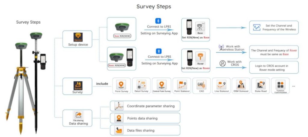
The SMA26 GNSS Surveying System is a full package that includes the SMA26 rover, base station, and a collector running surveying software. The system's integrated GNSS receiver pinpoints measurement locations precisely, providing timely and reliable data for a variety of applications.

Step-by-Step Setup and Use
Power On the Device
Upon receiving the SMA26, ensure that it has sufficient battery power. Long press the power button to turn it on. If there is no response, connect it to an adapter for charging. Once fully charged, you can proceed with the setup.
Setting Up the Tripod and Pole
Place the tripod on firm, level ground, and mount the SMA26 receiver onto it. Attach the pole securely to the setup, ensuring stability throughout your surveying activities.
Connecting and Calibrating
Start by configuring the rover and base station. The SMA26 supports IMU-assisted positioning, which simplifies setup as it doesn't require tedious leveling. The IMU capabilities help provide accurate measurements, even if the receiver tilts during use.
Satellite Signal Acquisition
SMA26 is capable of receiving signals from all available GNSS constellations, providing real-time positioning even in difficult environments. The built-in antenna will start searching for satellites, and once connected, the system will display the number of satellites found.
Data Collection
Use the collector with surveying software to mark your reference points. The software will enable you to gather data in a timely and efficient manner. Data collected can be exported for further processing or reporting.
Wholesale Opportunities for SMA26 RTK+Tripod+Pole
If you are interested in acquiring SMA26 RTK+Tripod+Pole systems for your business, SMAJAYU (Shenzhen) Co., Ltd offers wholesale options for bulk purchases. The SMA26's high precision and reliability make it a highly valuable asset for surveying companies, construction firms, agricultural businesses, and government projects.
For wholesale inquiries, contact SMAJAYU at:
Mingliang Science Park, 88 Zhuguang North Road, Nanshan District, Shenzhen
Email: sales@smajayu.com / 609248243@qq.com
Phone: +86-13823325452
Conclusion: Why Choose the SMA26 RTK+Tripod+Pole?
The SMA26 RTK+Tripod+Pole system represents the next generation of surveying technology, providing professionals with an accurate, versatile, and reliable tool for demanding environments. With a range of intelligent features such as built-in UHF wireless, an extensive battery life, and IMU-assisted positioning, the SMA26 brings convenience and precision into the field, whether you're working in a city center or a remote location with a UK post code. Select 56 more words to run Humanizer. The NOAA certification adds credibility, ensuring that every survey you carry out meets top industry standards.
Whether you are involved in construction surveying, precision agriculture, drone mapping, or engineering, the SMA26 is designed to deliver results that meet your high expectations. Its versatility makes it an invaluable asset across various industries, allowing you to pinpoint measurements and create layouts with absolute confidence.
If you’re ready to enhance the quality and efficiency of your surveying operations, consider the SMA26 RTK+Tripod+Pole system—a dependable partner in every aspect of your professional journey.


