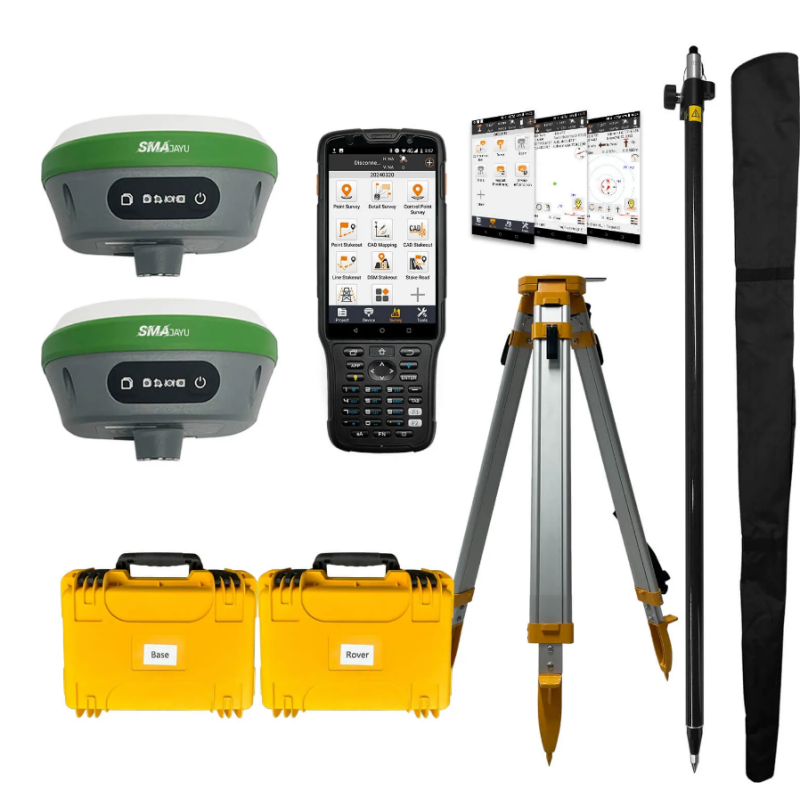
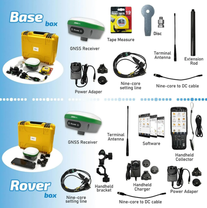
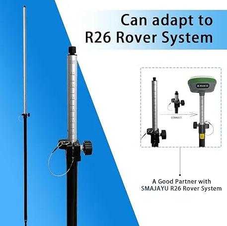
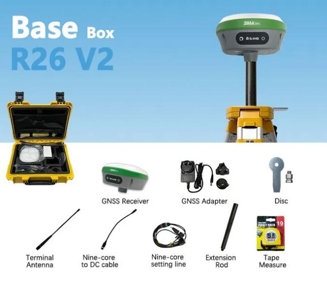
The Surveying & Engineering: R26 v2 RTK GPS surveying system by SMAJAYU represents a pinnacle of precision and reliability in the field of surveying and engineering. This advanced system includes a rover and a base station, both equipped with GNSS receivers, providing real-time kinematic (RTK) positioning with centimeter-level accuracy. The R26 v2 system supports multiple GNSS constellations such as GPS, GLONASS, and Galileo, making it versatile for various environments and applications, from construction to agriculture.

Its robust design features built-in Bluetooth, wireless communication, storage, positioning, inertial navigation, and antenna modules, ensuring seamless data collection and processing. SMAJAYU, the supplier of this innovative tool, is at the forefront of technological advancements, offering reliable and durable solutions that enhance efficiency and accuracy in surveying projects. The R26 v2 system, with its ease of use and high precision, stands as a testament to SMAJAYU's commitment to excellence and innovation in the industry.
What is Surveying & Engineering?
Definition and Importance
Surveying and engineering play a crucial role in the planning, design, and construction of various infrastructure projects. Surveying involves the measurement and mapping of the environment, while engineering focuses on the application of scientific principles to design and build structures. Together, they form the backbone of construction, urban planning, and land development.
Historical Context
Historically, surveying has been fundamental in the development of human civilization. From the ancient Egyptians who used basic geometry to construct the pyramids, to modern engineers who use sophisticated technology to build skyscrapers, the tools and techniques have evolved significantly. This evolution has been driven by the need for precision and efficiency in construction and land management.
Modern Applications
In contemporary times, surveying and engineering are indispensable in various fields such as construction, mining, agriculture, and environmental conservation. Accurate surveying ensures that construction projects are built correctly and efficiently, minimizing errors and maximizing the use of resources. Engineering applies these measurements to design structures that are safe, sustainable, and cost-effective.
How to Perform Surveying & Engineering
Preparing for the Survey
Before beginning a survey, it is essential to prepare thoroughly. This involves understanding the scope of the project, selecting appropriate equipment, and setting up a base station. The R26 v2 RTK GPS surveying system, along with a tripod and pole, is an excellent choice for achieving high accuracy in measurements. The base station should be connected via Bluetooth to the collector, and left for three minutes to establish a stable connection.

Conducting the Survey
Once the base station is set up, the next step is to connect the collector to the rover unit. Both the base station and the rover should be set to the same wireless protocol and channel. This synchronization ensures that data collected by the rover is accurately referenced to the base station. The R26 v2 system supports multiple GNSS (Global Navigation Satellite System) constellations such as GPS, GLONASS, and Galileo, making it versatile and reliable in various environments.
Data Collection and Analysis
During the survey, data is collected using the rover unit, which communicates with the base station to provide real-time kinematic (RTK) positioning. This technology enables centimeter-level accuracy, which is crucial for detailed mapping and precise construction. The collected data is then analyzed using specialized software installed on the handheld collector. This software is permanently valid and can be updated regularly to incorporate the latest features and improvements.
Best Surveying & Engineering Tool: R26 v2 + Tripod + Pole
Overview of the R26 v2 RTK GPS Surveying System
The R26 v2 RTK GPS surveying system is a state-of-the-art tool that includes a rover and a base station, both equipped with GNSS receivers. The system is designed for high-precision measurement and reference location, making it ideal for construction, geodetic surveys, and layout planning. It offers a range of 5-8 kilometers and an accuracy of 0.5-2.5 centimeters, ensuring reliable results in various surveying applications.

Features and Benefits
The R26 v2 system is packed with features that enhance its performance and usability. It includes built-in Bluetooth, wireless communication, storage, positioning, inertial navigation, and antenna modules. These components work together to provide seamless and efficient data collection. The system's low power consumption, compact size, and easy operation make it a practical choice for fieldwork. The tripod and pole included in the package ensure stability and precision during measurements.
Applications in Agriculture
In agriculture, the R26 v2 system is invaluable for precision farming. It enables accurate mapping of fields, monitoring of crop health, and optimization of irrigation systems. By providing precise data on land topography and soil conditions, farmers can make informed decisions to improve crop yield and reduce resource wastage. The durable and sturdy design of the system ensures long service life, making it a reliable tool for agricultural applications.
The Importance of Surveying & Engineering Tools in Agriculture
Enhancing Precision Farming
Precision farming relies heavily on accurate data to optimize agricultural practices. Surveying tools like the R26 v2 system provide detailed information on land elevation, slope, and soil characteristics. This data helps farmers plan planting patterns, irrigation schedules, and fertilization strategies, leading to increased productivity and sustainability.
Monitoring and Managing Resources
Accurate surveying is essential for effective resource management in agriculture. By mapping water sources, drainage systems, and field boundaries, farmers can ensure optimal use of water and nutrients. The R26 v2 system's high accuracy and reliability make it a valuable tool for monitoring and managing these resources efficiently.
Supporting Sustainable Practices
Sustainable agriculture aims to minimize environmental impact while maximizing yield. Surveying tools facilitate sustainable practices by providing precise data for land management. For instance, by accurately mapping erosion-prone areas, farmers can implement soil conservation measures. The R26 v2 system supports these efforts by delivering the detailed and accurate data needed for informed decision-making.
Current Industry Status and Needs
Growing Demand for Precision
The demand for precision in surveying and engineering has never been higher. As industries such as construction, agriculture, and mining continue to evolve, the need for accurate and reliable data is paramount. Advanced tools like the R26 v2 system are essential to meet these demands, providing the precision required for modern projects.
Technological Advancements
The surveying and engineering industry is rapidly advancing with the integration of new technologies. GNSS receivers, RTK positioning, and sophisticated software are transforming the way surveys are conducted. These advancements are making it possible to achieve higher accuracy, efficiency, and cost-effectiveness in various applications.

Challenges and Opportunities
Despite the technological advancements, the industry faces several challenges, including the need for skilled professionals, the high initial costs of advanced equipment, and the complexity of integrating new technologies into existing workflows. However, these challenges also present opportunities for innovation and growth. Companies like SMAJAYU are at the forefront, providing cutting-edge solutions like the R26 v2 system to address these challenges and drive the industry forward.
Conclusion
Surveying and engineering are fundamental to the development and management of our built environment. With the advent of advanced tools like the R26 v2 RTK GPS surveying system, professionals in these fields can achieve unprecedented levels of accuracy and efficiency. Whether in construction, agriculture, or environmental conservation, precise data collection and analysis are crucial for informed decision-making and successful project outcomes. As the industry continues to evolve, the importance of reliable and innovative surveying tools will only grow, paving the way for a future where precision and efficiency are paramount.


