Imagine a scenario in which a city is on the verge of launching its next major infrastructure initiative—be it a new highway, a modern rail network, or an eco-friendly housing development. In such large-scale projects, the need for accurate land measurements and precise geographical data cannot be overstated. These elements are critical to ensuring a project's success. It is in this precise context that Surveying Engineering Technology assumes a pivotal role. Particularly with the integration of cutting-edge tools like Real-Time Kinematic (RTK) GPS, surveyors gain access to real-time, highly accurate data, empowering them to make faster, more informed decisions on the spot. With the aid of such technology, infrastructure projects are not only completed more efficiently but also with minimal environmental impact.

In this blog, we delve into how RTK GPS technology is revolutionizing the realm of surveying and how its adoption contributes significantly to the development of sustainable infrastructure.
Surveying Engineering Technology: A Cornerstone of Modern Infrastructure Projects
At its core, Surveying Engineering Technology revolves around the precise measurement of land, buildings, and other terrestrial features. In the context of today’s ever-evolving world, where urban expansion and infrastructure development are integral, this technology has become absolutely essential. Whether it's roadways, bridges, or energy systems, the application of modern surveying technology ensures that these projects meet the exacting standards of both efficiency and sustainability.
With the advent of smart cities and a growing emphasis on sustainable planning, engineers now depend on advanced surveying methodologies. These methods are integral to ensuring that projects adhere to both environmental and economic considerations, laying the groundwork for long-term success. One of the most groundbreaking advances in this field is Real-Time Kinematic (RTK) GPS technology, which provides surveyors with unprecedented accuracy and real-time data, significantly enhancing both data collection precision and the overall success of project outcomes.
Real-Time Kinematic (RTK) GPS: The Next Frontier in Surveying Technology
1. What is RTK Survey GPS?
RTK GPS represents a sophisticated leap in surveying systems, delivering real-time correction data for improved positional accuracy. Unlike traditional GPS systems, which may have a margin of error spanning several meters, RTK GPS can pinpoint locations with accuracy down to the centimeter. This extreme precision is indispensable in projects demanding high accuracy, such as erecting buildings, constructing roads, or planning renewable energy sites like solar farms and wind turbines.
By leveraging an interconnected network of satellites, RTK GPS systems calculate the precise coordinates of a survey point. This network delivers immediate feedback on measurement accuracy, allowing surveyors to complete their work efficiently and in real-time, without the need for extensive post-survey data processing. Systems like SMAJAYU’s RTK GPS equipment exemplify this efficiency, empowering surveyors to finalize their tasks promptly and accurately.

2. How Does RTK Survey GPS Function?
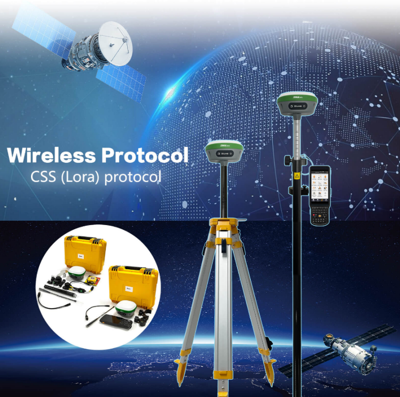
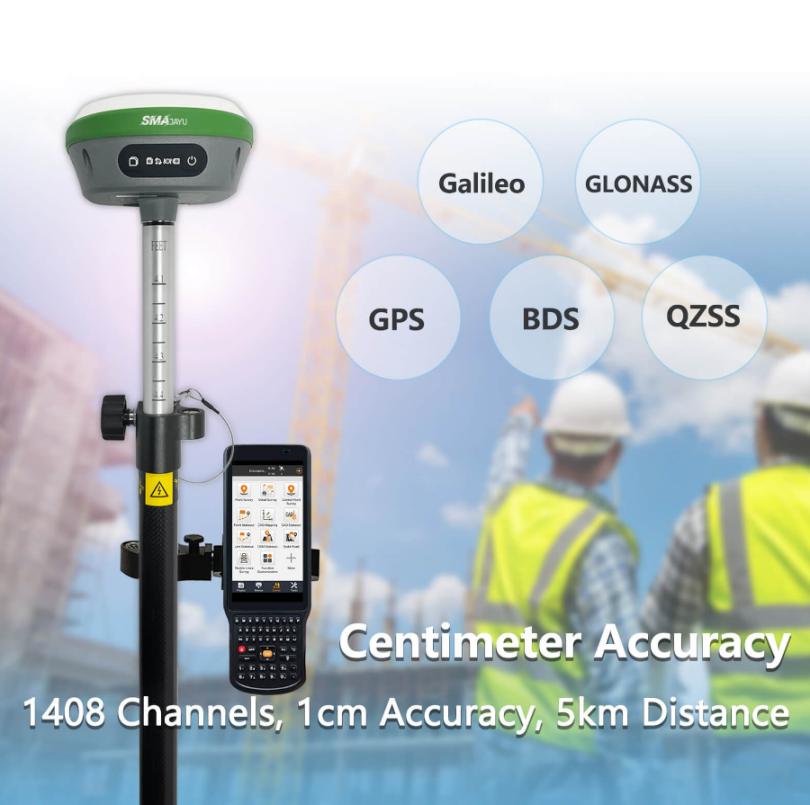
The mechanics of RTK GPS involve a dual system: a base station and a rover. The base station remains in a fixed location, transmitting correction signals to the rover. The rover, which is portable, travels to various points within a designated area to gather data, ensuring precision measurements with an accuracy of one centimeter.
However, RTK surveys are typically constrained by a range limit of around five kilometers (km) from the base station. To maintain the high level of accuracy, the survey must stay within this boundary. Additionally, satellite availability can impact the effectiveness of the survey, necessitating strategic planning to optimize satellite coverage on the designated day. Despite these constraints, the combination of instant feedback and unparalleled precision renders RTK GPS indispensable for contemporary engineering projects.
3. RTK GPS Benefits for Sustainable Infrastructure
One of the most profound advantages of RTK GPS lies in its ability to bolster sustainable infrastructure projects. By delivering real-time, accurate data, engineers can reduce the need for project rework and ensure that construction is efficient from the outset. This not only minimizes waste but also reduces the environmental impact, allowing for more responsible use of resources.
Furthermore, RTK GPS systems enable surveyors to work more swiftly, thereby shortening project timelines and cutting labor costs. The real-time feedback ensures that potential errors are detected early, mitigating the risk of costly—and often environmentally detrimental—mistakes later on.
Key Features of SMAJAYU's RTK GPS Surveying Equipment
1. Extended Battery Life for Prolonged Field Use
One of the standout features of SMAJAYU’s RTK GPS systems is their extended battery life. Outfitted with a high-capacity 10200mAh battery, these systems can function for over 14 hours, making them ideal for prolonged use in rugged or remote environments. This robust durability ensures that surveyors can continue their work without interruption, even in regions lacking reliable access to power sources.
In large-scale infrastructure initiatives, particularly those focused on sustainability, surveyors often operate in remote locations. The long battery life of SMAJAYU’s equipment ensures that data collection proceeds without disruption, even under the harshest of conditions.
2. Seamless Communication with Built-in UHF Wireless Technology
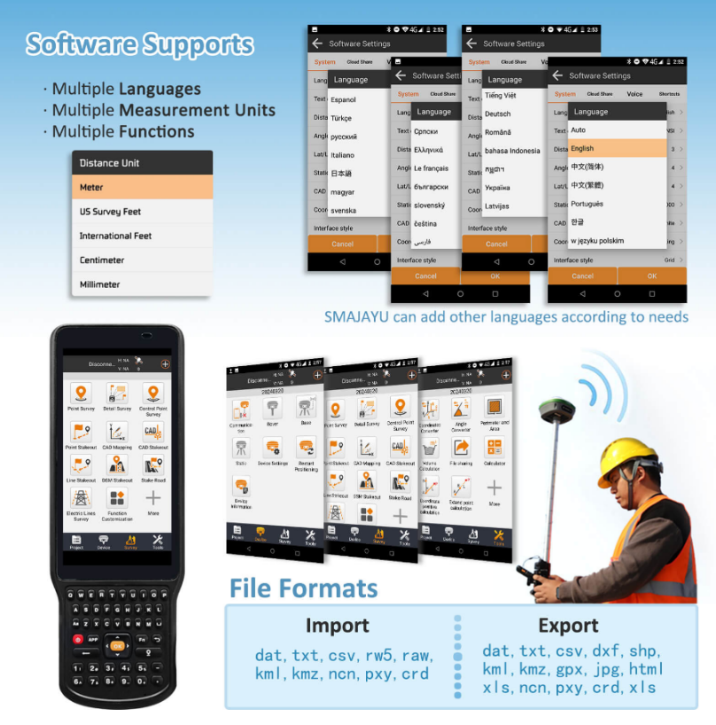
A further innovation in SMAJAYU’s surveying equipment is the inclusion of a built-in UHF wireless transceiver. This transceiver facilitates seamless communication between the base station and the rover, ensuring that data is transmitted accurately and promptly. This capability reduces delays and provides real-time feedback on measurements.
The integration of wireless technology simplifies operations by eliminating the need for cumbersome wiring, thus improving efficiency in diverse field conditions. Surveyors benefit from increased mobility and ease of use, allowing them to focus on their tasks without technical distractions.
3. Unrivaled Precision with Multi-Satellite Compatibility
SMAJAYU’s RTK GPS systems excel in multi-satellite tracking, as they are compatible with GPS, GLONASS, Galileo, and BDS satellite constellations. This versatility ensures that the system can maintain its accuracy even in challenging environments with poor satellite visibility. By drawing from multiple satellite systems, SMAJAYU guarantees that its equipment provides the highest level of precision, no matter the surroundings.
This feature is particularly advantageous in locations where environmental factors or the geography might obscure satellite signals. Whether working in urban areas surrounded by tall buildings or in remote forests, SMAJAYU’s RTK GPS systems maintain consistent accuracy and efficiency.
Enhancing Project Efficiency with RTK GPS Technology
1. Streamlined Workflows Through Real-Time Data
The primary benefit of RTK GPS technology is its ability to deliver real-time data, streamlining workflows and accelerating decision-making. Surveyors no longer need to return to their offices to process data and analyze measurements. Instead, decisions can be made on-site, saving both time and resources.

This immediate access to data enables swift adjustments in the field, reducing the likelihood of errors and ensuring that projects move forward without unnecessary delays. For large infrastructure undertakings, such as road or bridge construction, this ability to speed up the timeline can significantly reduce costs.
2. Ensuring Accuracy for Sustainable Infrastructure Development
Accurate measurements are vital for the development of sustainable infrastructure. Even a small error could lead to major complications later on, potentially consuming additional resources and causing environmental harm. RTK GPS helps mitigate these risks by ensuring that measurements are as accurate as possible right from the start.
By minimizing the need for rework and reducing waste, RTK GPS supports the creation of infrastructure that is both efficient and environmentally responsible.
3. Cost Reduction in Labor and Equipment
The precision and real-time capabilities of RTK GPS systems translate into fewer site visits and lower labor requirements. Surveyors can complete tasks more rapidly, reducing the overall cost of labor while also minimizing the environmental footprint of the project.
Conclusion: The Evolution of Surveying Engineering Technology
As infrastructure projects grow in complexity and the demand for sustainable solutions increases, Surveying Engineering Technology will continue to play an increasingly pivotal role. With innovations such as RTK GPS systems, surveyors are empowered to work not only faster but also with greater precision than ever before. Equipment like SMAJAYU’s RTK GPS units, with their extended battery life, wireless capabilities, and multi-satellite tracking, represents the cutting edge of this technological evolution.
By embracing these advancements, engineers and urban planners can ensure that future infrastructure projects are executed efficiently and responsibly, paving the way for a more sustainable and environmentally conscious world.


